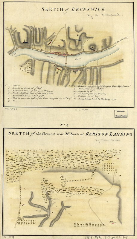
Sketch of Brunswick : Sketch of the ground near Mr. Low's at Rariton Landing
This map is also available in American Revolutionary Geographies Online (ARGO), a collections portal especially built for material relating to the American Revolutionary War Era. Visit ARGO to learn more about this item and explore the historical geography of North America in the late eighteenth century.
Item Information
- Title:
- Sketch of Brunswick : Sketch of the ground near Mr. Low's at Rariton Landing
- Title (alt.):
-
Brunswick
Rariton Landing
- Creator:
- Sutherland, Alexander, (Engineer)
- Date:
-
[1777?]
- Format:
-
Maps/Atlases
Manuscripts
- Location:
- Library of Congress Geography and Map Division
- Collection (local):
-
Library of Congress Collection
- Subjects:
-
New Brunswick (N.J.)--History--Revolution, 1775-1783--Maps--Early works to 1800
New Brunswick (N.J.)--Maps, Manuscript--Early works to 1800
- Places:
-
Middlesex (county)New Brunswick
- Extent:
- 2 col. maps; on sheet 52 x 31 cm.
- Terms of Use:
-
No known copyright restrictions.
This work is licensed for use under a Creative Commons Attribution Non-Commercial Share Alike License (CC BY-NC-SA).

- Scale:
-
Scale ca. 1:12,000 and scale not given
- Language:
-
English
- Catalog Record:
-
https://lccn.loc.gov/gm72003593
- Notes:
-
Manuscript, pen-and-ink and watercolor.
Watermark: J. Whatman.
Relief shown by shading.
No. 3 includes numbered location index to redoubts, troop positions, etc.
Accompanied by Hills map collection title page and table of contents.
- Notes (citation):
-
LC Maps of North America, 1750-1789, 1272
- Identifier:
-
ar127200


