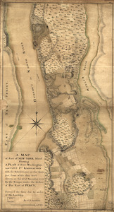
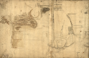
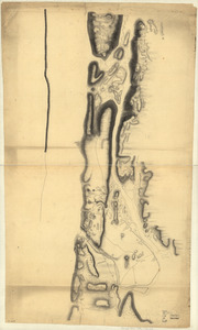
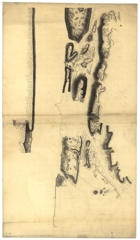
Unfinished draught for a topographical map of the northern part of New York Island
This map is also available in American Revolutionary Geographies Online (ARGO), a collections portal especially built for material relating to the American Revolutionary War Era. Visit ARGO to learn more about this item and explore the historical geography of North America in the late eighteenth century.
Item Information
- Title:
- Unfinished draught for a topographical map of the northern part of New York Island
- Date:
-
[1778?]
- Format:
-
Maps/Atlases
Manuscripts
- Location:
- Library of Congress Geography and Map Division
- Collection (local):
-
Library of Congress Collection
- Subjects:
-
Manhattan (New York, N.Y.)--Maps, Manuscript--Early works to 1800
- Places:
-
New YorkManhattan
- Extent:
- 1 manuscript map, on sheet 102 x 58 cm.
- Terms of Use:
-
No known copyright restrictions.
This work is licensed for use under a Creative Commons Attribution Non-Commercial Share Alike License (CC BY-NC-SA).

- Scale:
-
Scale ca. 1:7,500
- Language:
-
English
- Catalog Record:
-
https://lccn.loc.gov/gm71002306
- Notes:
-
Manuscript, pen-and-ink, pencil, and watercolor.
Relief shown by shading.
Shows Fort Lee, Fort Washington, Fort Independence, the 8 redoubts built by the British to command Kingsbridge, troop symbols, and the entrenchments on Harlem Heights.
- Notes (citation):
-
LC Maps of North America, 1750-1789, 1171
- Identifier:
-
ar117100z