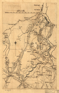
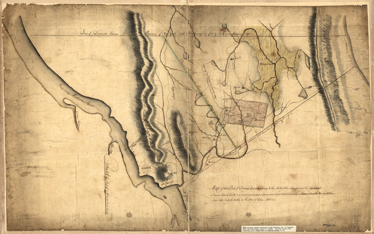
Map of that part of Orange County lying to the north of the mountains of the highlands : shewing that Chester is a much more central & convenient spott to all the country whereon to erect the new court house than that vulgarly known by the name of Goshen Town
This map is also available in American Revolutionary Geographies Online (ARGO), a collections portal especially built for material relating to the American Revolutionary War Era. Visit ARGO to learn more about this item and explore the historical geography of North America in the late eighteenth century.
Item Information
- Title:
- Map of that part of Orange County lying to the north of the mountains of the highlands : shewing that Chester is a much more central & convenient spott to all the country whereon to erect the new court house than that vulgarly known by the name of Goshen Town
- Date:
-
[1770?–1779?]
- Format:
-
Maps/Atlases
Manuscripts
- Location:
- Library of Congress Geography and Map Division
- Collection (local):
-
Library of Congress Collection
- Subjects:
-
Orange County (N.Y.)--Maps, Manuscript--Early works to 1800
- Places:
-
Orange (county)
- Extent:
- 1 manuscript map : hand color 65 x 104 cm.
- Terms of Use:
-
No known copyright restrictions.
This work is licensed for use under a Creative Commons Attribution Non-Commercial Share Alike License (CC BY-NC-SA).

- Scale:
-
Scale 1:79,200
- Language:
-
English
- Catalog Record:
-
https://lccn.loc.gov/73691649
- Notes:
-
Manuscript, pen-and-ink and watercolor.
Oriented with north to the bottom.
Relief shown by shading.
- Notes (citation):
-
LC Maps of North America, 1750-1789, 1089
- Identifier:
-
ar108900z