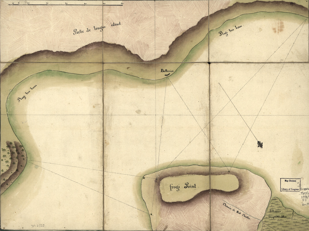
Frog's Point avec batteries de Partie de Longue Island
This map is also available in American Revolutionary Geographies Online (ARGO), a collections portal especially built for material relating to the American Revolutionary War Era. Visit ARGO to learn more about this item and explore the historical geography of North America in the late eighteenth century.
Item Information
- Title:
- Frog's Point avec batteries de Partie de Longue Island
- Title (alt.):
-
Reconnoissance de King's bridge
- Date:
-
[1781?]
- Format:
-
Maps/Atlases
Manuscripts
- Location:
- Library of Congress Geography and Map Division
- Collection (local):
-
Library of Congress Collection
- Subjects:
-
Throgs Neck (N.Y. : Cape)--History--Revolution, 1775-1783--Maps, Manuscript--Early works to 1800
- Places:
-
Bronx (county)Throgs Neck (cape)
- Extent:
- 1 manuscript map : hand color 31 x 42 cm. fold. to 23 x 15 cm.
- Terms of Use:
-
No known copyright restrictions.
This work is licensed for use under a Creative Commons Attribution Non-Commercial Share Alike License (CC BY-NC-SA).

- Scale:
-
Scale ca. 1:7,700
- Language:
-
French
- Catalog Record:
-
https://lccn.loc.gov/gm71002333
- Notes:
-
Folded title, on label: Reconnoissance de King's bridge.
Manuscript, pen-and-ink and watercolor.
Has watermarks.
Oriented with north toward the lower right.
Relief shown by shading.
Sectioned and mounted on cloth backing.
Shows command of "Frog's Point" by batteries and two other points on Long Island.
- Notes (citation):
-
LC Maps of North America, 1750-1789, 1217
- Identifier:
-
ar121700

![A survey of Frog's Neck and the rout[e] of the British Army](https://bpldcassets.blob.core.windows.net/derivatives/images/commonwealth:q524n8606/image_thumbnail_300.jpg)


