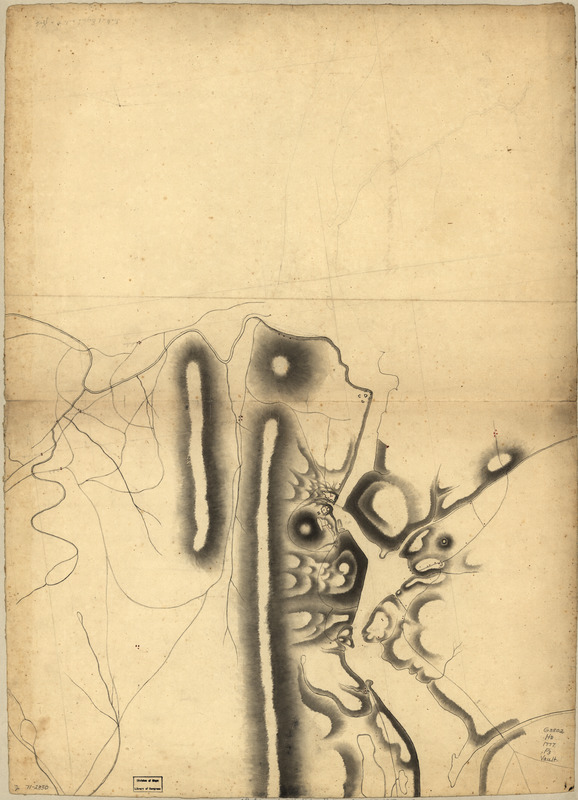
Part of a map of the Hudson Highlands showing Forts Clinton and Montgomery
This map is also available in American Revolutionary Geographies Online (ARGO), a collections portal especially built for material relating to the American Revolutionary War Era. Visit ARGO to learn more about this item and explore the historical geography of North America in the late eighteenth century.
Item Information
- Title:
- Part of a map of the Hudson Highlands showing Forts Clinton and Montgomery
- Date:
-
[1777?]
- Format:
-
Maps/Atlases
Manuscripts
- Location:
- Library of Congress Geography and Map Division
- Collection (local):
-
Library of Congress Collection
- Subjects:
-
Manuscript maps
Hudson Highlands (N.Y.)--Maps, Manuscript--Early works to 1800
Fort Clinton, N.Y. (Rockford Co.)--Maps--Early works to 1800
Fort Montgomery, N.Y--Maps--Early works to 1800
- Places:
-
Orange (county)Hudson Highlands State Park
Orange (county)Fort Montgomery
Rockland (county)Fort Clinton
- Extent:
- 1 manuscript map : hand color, on sheet 77 x 56 cm.
- Terms of Use:
-
No known copyright restrictions.
This work is licensed for use under a Creative Commons Attribution Non-Commercial Share Alike License (CC BY-NC-SA).

- Scale:
-
Scale ca. 1:70,000
- Language:
-
English
- Catalog Record:
-
https://lccn.loc.gov/gm71002330
- Notes:
-
Manuscript, pen-and-ink and watercolor.
Relief shown by hachures and shading.
Has watermarks.
Northern of two or more sheets.
Incorrect scale note in pencil.
Shows a few place names in Orange County very lightly in pencil.
In lower left corner: H.R.
On verso, in ink: Major Dornford, Roy. Engrs.
Scale not "1 English mile to a foot" as indicated.
- Notes (citation):
-
LC Maps of North America, 1750-1789, 1192
- Identifier:
-
ar119200


![Armstrong C[ount]y](https://bpldcassets.blob.core.windows.net/derivatives/images/commonwealth:q524ng353/image_thumbnail_300.jpg)

