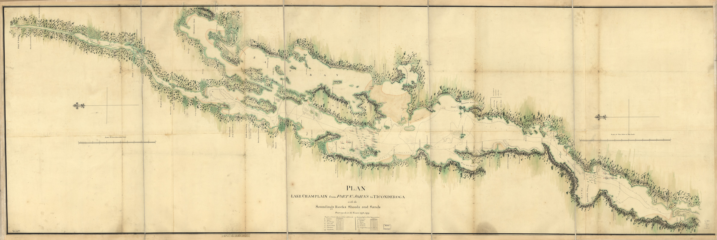
Plan, Lake Champlain from Fort St. John's to Ticonderoga : with the soundings, rocks, shoals, and sands, surveyed in the years 1778, 1779
This map is also available in American Revolutionary Geographies Online (ARGO), a collections portal especially built for material relating to the American Revolutionary War Era. Visit ARGO to learn more about this item and explore the historical geography of North America in the late eighteenth century.
Item Information
- Title:
- Plan, Lake Champlain from Fort St. John's to Ticonderoga : with the soundings, rocks, shoals, and sands, surveyed in the years 1778, 1779
- Date:
-
[1779]
- Format:
-
Maps/Atlases
Manuscripts
- Location:
- Library of Congress Geography and Map Division
- Collection (local):
-
Library of Congress Collection
- Subjects:
-
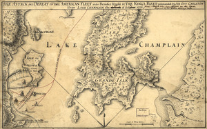
Champlain, Lake--Maps, Manuscript--Early works to 1800
Valcour Island, Battle of, N.Y., 1776--Maps, Manuscript--Early works to 1800
- Places:
-
Clinton (county)Valcour Island (island)
Champlain, Lake
- Extent:
- 1 manuscript map : hand color, 82 x 259 cm.
- Terms of Use:
-
No known copyright restrictions.
This work is licensed for use under a Creative Commons Attribution Non-Commercial Share Alike License (CC BY-NC-SA).

- Scale:
-
Scale 1:63,360
- Language:
-
English
- Catalog Record:
-
https://lccn.loc.gov/gm71000657
- Notes:
-
Manuscript, pen-and-ink and watercolor.
Oriented with north to the left.
Shows ships present at the Battle of Valcour Island, Oct. 11, 1776 and a running fight at Buttonmold Bay, Oct., 13, 1776.
- Notes (date):
-
This date is inferred.
- Notes (citation):
-
LC Maps of North America, 1750-1789, 1176
- Identifier:
-
ar117600z

![[A map of Lake Champlain and Lake George, showing the route from Fort Edward to Montreal]](https://bpldcassets.blob.core.windows.net/derivatives/images/commonwealth:hx11z3312/image_thumbnail_300.jpg)
