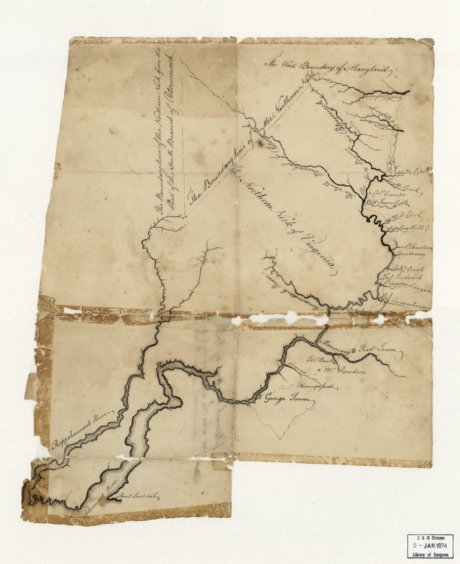
Potomack
This map is also available in American Revolutionary Geographies Online (ARGO), a collections portal especially built for material relating to the American Revolutionary War Era. Visit ARGO to learn more about this item and explore the historical geography of North America in the late eighteenth century.
Item Information
- Title:
- Potomack
- Creator:
- Booth, Robert, -1791
- Name on Item:
-
laid down by R. Bo[oth] as also the adjacent waters
- Date:
-
[1770–1779]
- Format:
-
Maps/Atlases
Manuscripts
- Location:
- Library of Congress Geography and Map Division
- Collection (local):
-
Library of Congress Collection
- Subjects:
-
Potomac River--Maps--Early works to 1800
Potomac River Estuary--Maps--Early works to 1800
Rappahannock River (Va.)--Maps--Early works to 1800
Northern Neck (Va.)--Maps--Early works to 1800
- Places:
-
Rappahannock (river)
Potomac (river)
- Extent:
- 1 manuscript map ; on sheet 36 x 31 cm, folded to 16 x 11 cm
- Terms of Use:
-
No known copyright restrictions.
This work is licensed for use under a Creative Commons Attribution Non-Commercial Share Alike License (CC BY-NC-SA).

- Scale:
-
Scale not given
- Language:
-
English
- Catalog Record:
-
https://lccn.loc.gov/74694669
- Notes:
-
Covers the Potomac River (estuary and river), its tributaries, and the Rappahannock River.
Also covers "The Northern Neck of Virginia".
Title from annotation on verso.
Manuscript: pen-and-ink.
Condition imperfect: Torn at fold lines, missing small internal sections at fold lines and at sheet edges, formerly taped.
Accompanied by carbon-copy of LC letter of acceptance addressed to donor.
- Notes (date):
-
This date is inferred.
- Identifier:
-
ar143900r


