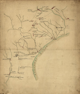
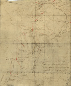
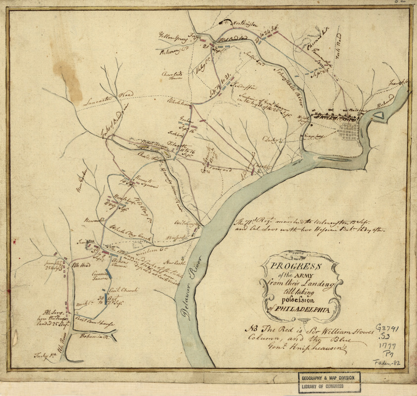
Progress of the army from their landing till taking possession of Philadelphia
This map is also available in American Revolutionary Geographies Online (ARGO), a collections portal especially built for material relating to the American Revolutionary War Era. Visit ARGO to learn more about this item and explore the historical geography of North America in the late eighteenth century.
Item Information
- Title:
- Progress of the army from their landing till taking possession of Philadelphia
- Date:
-
[1777?]
- Format:
-
Maps/Atlases
Manuscripts
- Location:
- Library of Congress Geography and Map Division
- Collection (local):
-
Library of Congress Collection
- Subjects:
-
Middle Atlantic States--History--Revolution, 1775-1783--Campaigns--Maps, Manuscript--Early works to 1800
- Places:
-
Middle Atlantic (area)
- Extent:
- 1 manuscript map : hand color 25 x 27 cm.
- Terms of Use:
-
No known copyright restrictions.
This work is licensed for use under a Creative Commons Attribution Non-Commercial Share Alike License (CC BY-NC-SA).

- Scale:
-
Scale ca. 1:350,000
- Language:
-
English
- Catalog Record:
-
https://lccn.loc.gov/gm71000678
- Notes:
-
Manuscript, pen-and-ink and watercolor.
Has watermark.
Relief shown by hachures.
Shows camps and battles between Elkton, Md., Valley Forge, and Philadelphia.
- Notes (citation):
-
LC Maps of North America, 1750-1789, 1061
- Identifier:
-
ar106100