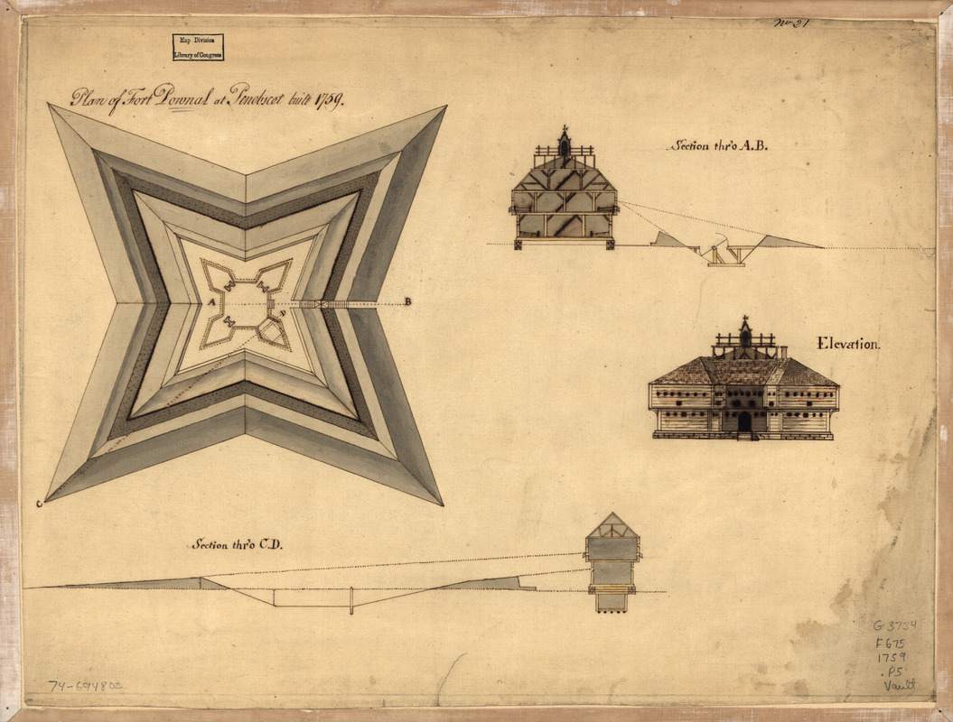
Plan of Fort Pownal at Penobscot built 1759
This map is also available in American Revolutionary Geographies Online (ARGO), a collections portal especially built for material relating to the American Revolutionary War Era. Visit ARGO to learn more about this item and explore the historical geography of North America in the late eighteenth century.
Item Information
- Title:
- Plan of Fort Pownal at Penobscot built 1759
- Date:
-
[1759?]
- Format:
-
Maps/Atlases
Manuscripts
- Location:
- Library of Congress Geography and Map Division
- Collection (local):
-
Library of Congress Collection
- Subjects:
-
Fort Pownall (Me.)--Maps, Manuscript--Early works to 1800
- Places:
-
Fort Point State Park
- Extent:
- 1 manuscript map : hand color 37 x 48 cm.
- Terms of Use:
-
No known copyright restrictions.
This work is licensed for use under a Creative Commons Attribution Non-Commercial Share Alike License (CC BY-NC-SA).

- Scale:
-
Scale not given
- Language:
-
English
- Catalog Record:
-
https://lccn.loc.gov/74694802
- Notes:
-
Manuscript, pen-and-ink and watercolor.
"No. 21."
Watermark: J. Whatman.
Includes 3 profile views.
- Notes (citation):
-
LC Maps of North America, 1750-1789, 837
- Identifier:
-
ar083700