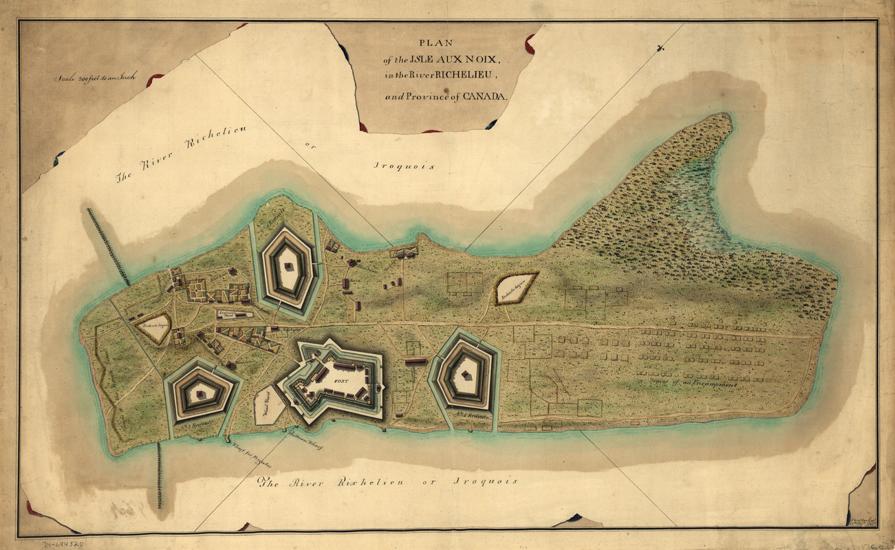
Plan of the Isle aux Noix, in the River Richelieu, and Province of Canada
This map is also available in American Revolutionary Geographies Online (ARGO), a collections portal especially built for material relating to the American Revolutionary War Era. Visit ARGO to learn more about this item and explore the historical geography of North America in the late eighteenth century.
Item Information
- Title:
- Plan of the Isle aux Noix, in the River Richelieu, and Province of Canada
- Creator:
- Walker, Thomas, active 18th century
- Name on Item:
-
[Signed:] T. Walker, Capt., 60th regt. delt.
- Date:
-
[1760?]
- Format:
-
Maps/Atlases
Manuscripts
- Location:
- Library of Congress Geography and Map Division
- Collection (local):
-
Library of Congress Collection
- Subjects:
-
Fortification--Québec (Province)--Noix Island (Le Haut-Richelieu)--Maps--Early works to 1800
Noix Island (Le Haut-Richelieu, Québec)--Defenses--Maps--Early works to 1800
Fort Lennox (Québec)--Maps--Early works to 1800
Manuscript maps
- Places:
-
CanadaFort Lennox National Historic Park (historical park)
Île aux Noix
- Extent:
- 1 manuscript map : hand color ; 42 x 72 cm.
- Terms of Use:
-
No known copyright restrictions.
This work is licensed for use under a Creative Commons Attribution Non-Commercial Share Alike License (CC BY-NC-SA).

- Scale:
-
Scale 1:2,400
- Language:
-
English
- Catalog Record:
-
https://lccn.loc.gov/74694520
- Notes:
-
Manuscript, pen-and-ink and watercolor.
Relief shown by shading.
Oriented with north toward the upper right.
Annotated on verso: No. 4. Plan of the Isle aux Noix.
- Notes (citation):
-
LC Maps of North America, 1750-1789, 620
- Identifier:
-
ar062000


![Armstrong C[ount]y](https://bpldcassets.blob.core.windows.net/derivatives/images/commonwealth:q524ng353/image_thumbnail_300.jpg)


