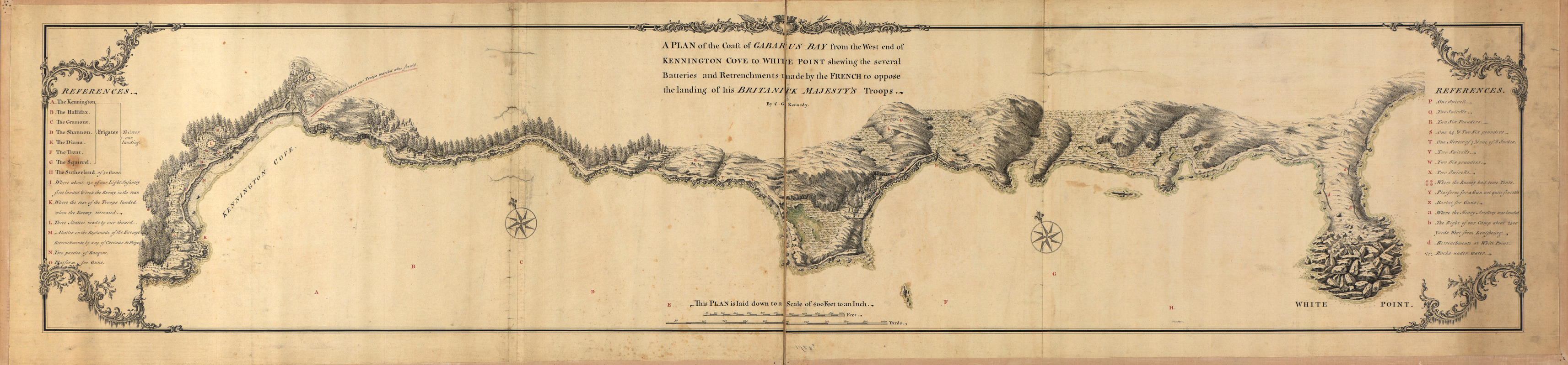
A plan of the coast of Gabarus Bay from the west end of Kennington Cove to White Point shewing the several batteries and retrenchments made by the French to oppose the landing of His Britanick Majesty's troops
This map is also available in American Revolutionary Geographies Online (ARGO), a collections portal especially built for material relating to the American Revolutionary War Era. Visit ARGO to learn more about this item and explore the historical geography of North America in the late eighteenth century.
Item Information
- Title:
- A plan of the coast of Gabarus Bay from the west end of Kennington Cove to White Point shewing the several batteries and retrenchments made by the French to oppose the landing of His Britanick Majesty's troops
- Creator:
- Kennedy, C. G.
- Name on Item:
-
by C.G. Kennedy
- Date:
-
[1758?]
- Format:
-
Maps/Atlases
Manuscripts
- Location:
- Library of Congress Geography and Map Division
- Collection (local):
-
Library of Congress Collection
- Subjects:
-
Coast defenses--Nova Scotia--Gabarus Bay--Maps--Early works to 1800
Intrenchments--Nova Scotia--Gabarus Bay--Maps--Early works to 1800
Gabarus Bay (N.S.)--Maps, Manuscript--Early works to 1800
- Places:
-
CanadaGabarus Bay
- Extent:
- 1 ms. map : col. ; 29 x 139 cm.
- Terms of Use:
-
No known copyright restrictions.
This work is licensed for use under a Creative Commons Attribution Non-Commercial Share Alike License (CC BY-NC-SA).

- Scale:
-
Scale [ca. 1:4,900]
- Language:
-
English
- Catalog Record:
-
https://lccn.loc.gov/2007627827
- Notes:
-
Relief shown pictorially and by shading.
Pen-and-ink and watercolors.
Indexed.
- Identifier:
-
ar303200


