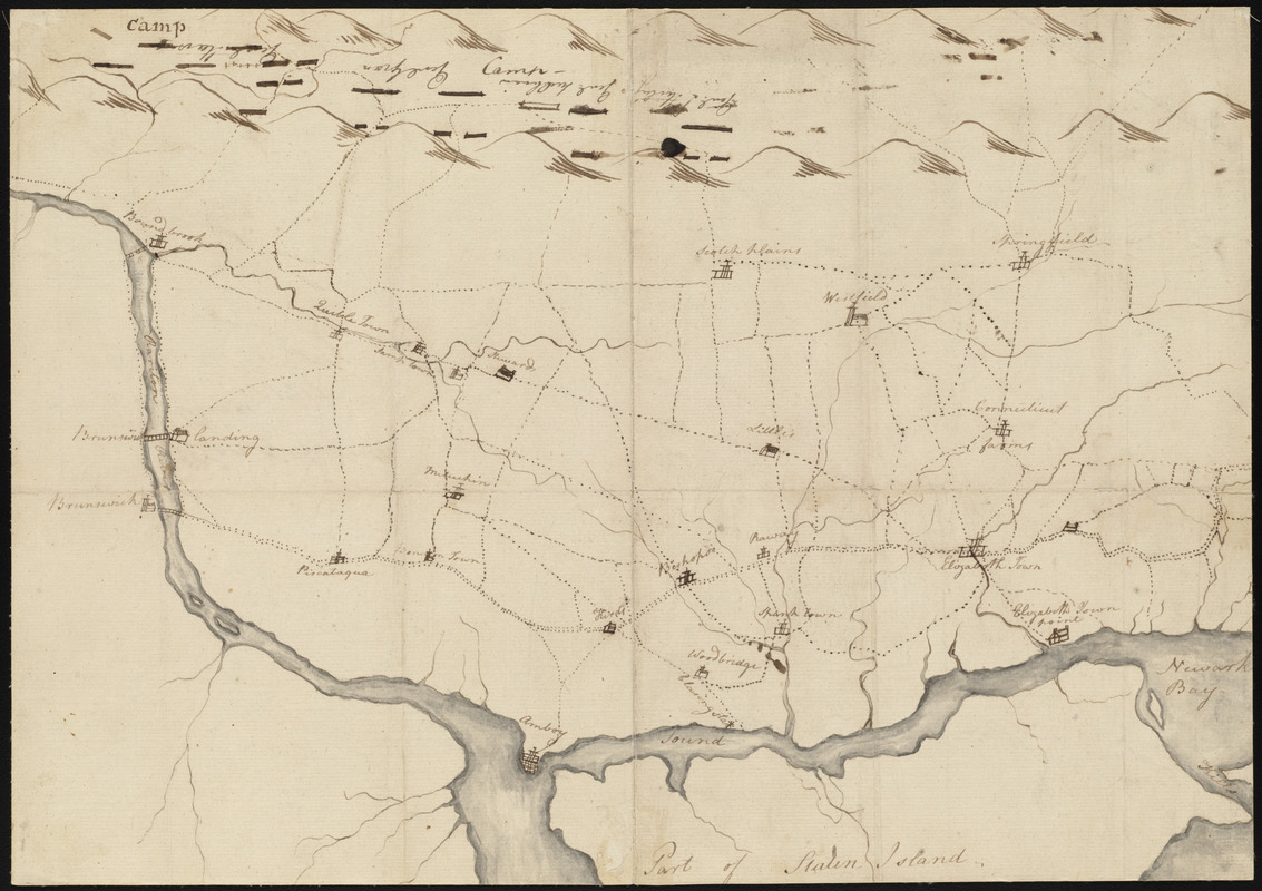
Map of American camp in New Jersey and surrounding countryside
This map is also available in American Revolutionary Geographies Online (ARGO), a collections portal especially built for material relating to the American Revolutionary War Era. Visit ARGO to learn more about this item and explore the historical geography of North America in the late eighteenth century.
Item Information
- Title:
- Map of American camp in New Jersey and surrounding countryside
- Creator:
- Knox, Henry, 1750-1806
- Date:
-
1777
- Format:
-
Maps/Atlases
Manuscripts
- Location:
-
Boston Public Library
Rare Books Department - Collection (local):
-
Special Collections, Rare Books
- Subjects:
-
New Jersey--Maps
United States--History--Revolution, 1775-1783--Maps
United States--History--Revolution, 1775-1783--Sources
- Places:
-
New Jersey
- Extent:
- 1 map ; 28.8 x 40.8 cm.
- Terms of Use:
-
No known copyright restrictions.
No known restrictions on use.
- Place of origin:
-
Morristown, N.J.
- Language:
-
English
- Notes:
-
Holograph.
Plan of the North River [i.e. area north of Raritan River between Bound Brook and Amboy north to Springfield and Elizabeth with American position in mountains to the west noted].
This probably accompanied Knox's letter of 19 April 1777 to Henry Jackson.
Title provided by cataloger.
- Identifier:
-
06_01_004501
- Call #:
-
BPL Rare Books Dept. ms.vCh.C.2.87
- Barcode:
-
39999063813701


