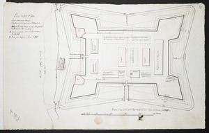
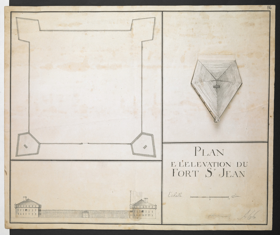
PLAN E L'ELEVATION DU FORT S.T JEAN
This map is also available in American Revolutionary Geographies Online (ARGO), a collections portal especially built for material relating to the American Revolutionary War Era. Visit ARGO to learn more about this item and explore the historical geography of North America in the late eighteenth century.
Item Information
- Title:
- PLAN E L'ELEVATION DU FORT S.T JEAN
- Former owner:
- Amherst, Jeffery Amherst, Baron, 1717-1797
- Former owner:
- Royal United Services Institute for Defence and Security Studies
- Date:
-
[1748–1760]
- Format:
-
Maps/Atlases
- Location:
- British Library
- Collection (local):
-
British Library Collection
- Subjects:
-
Fortification--Québec (Province)--Saint-Jean-sur-Richelieu--Maps, Manuscript--Early works to 1800
Military art and science--Québec (Province)--Saint-Jean-sur-Richelieu--Maps, Manuscript--Early works to 1800
Saint-Jean-sur-Richelieu (Québec)--Maps, Manuscript--Early works to 1800
- Places:
-
CanadaSaint-Jean-sur-Richelieu
- Extent:
- 1 map : manuscript pen and ink with grey wash ; 31 x 37 cm
- Terms of Use:
-
No known copyright restrictions.
This work is licensed for use under a Creative Commons Attribution Non-Commercial Share Alike License (CC BY-NC-SA).

- Publisher:
-
[Place of production not identified] :
[Producer not identified]
- Scale:
-
Scale approximately 1:360
- Language:
-
French
- Catalog Record:
-
http://searcharchives.bl.uk/IAMS_VU2:IAMS040-001999744
- Notes:
-
Shows Fort Saint-Jean on the Richlieu River, as it was between 1748 and 1760.
The map is inset with an elevation of the fort at lower left, the title and scale bar (in toises) at lower right, and a bird's-eye view of each of the floors of the bastion at upper right - these bird's-eye views are presented as flaps that lift to reveal the floor beneath; the roof forms the uppermost flap with each of the subsequent floors to follow.
Copy at Add Ms 57,712.16. Bound in R.U.S.I. Vol LXXVII. Shows manuscript addition of "16" in pencil at upper right. Manuscript addition of "A 66" in pencil at lower right. Laid on archival tissue. Green circular label to verso shows "20". White label to verso shows "DRAWER 30 SECTION 1". Blue label to verso shows "A 30/44". Manuscript annotation in ink to verso shows "Fort S.t Jean". Evidence of old folds.
- Notes (date):
-
This date is inferred.