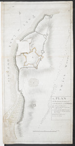
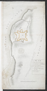
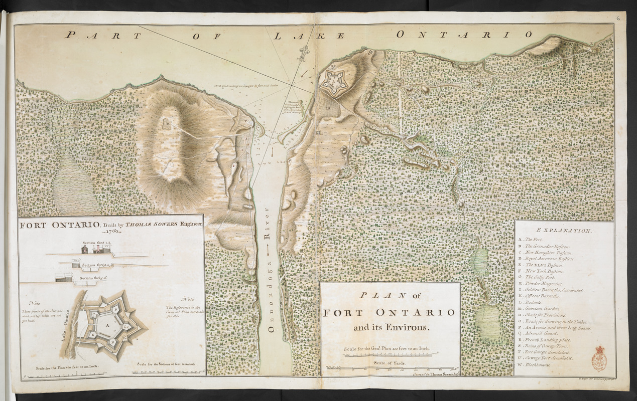
PLAN of FORT ONTARIO and its ENVIRONS
This map is also available in American Revolutionary Geographies Online (ARGO), a collections portal especially built for material relating to the American Revolutionary War Era. Visit ARGO to learn more about this item and explore the historical geography of North America in the late eighteenth century.
Item Information
- Title:
- PLAN of FORT ONTARIO and its ENVIRONS
- Surveyor:
- Sowers, Thomas
- Former owner:
- Amherst, Jeffery Amherst, Baron, 1717-1797
- Former owner:
- Royal United Services Institute for Defence and Security Studies
- Name on Item:
-
Survey'd by Thomas Sowers Engin.r.
- Date:
-
1760
- Format:
-
Maps/Atlases
- Location:
- British Library
- Collection (local):
-
British Library Collection
- Subjects:
-
Fortification--New York (State)--Oswego--Maps, Manuscript--Early works to 1800
Military art and science----New York (State)--Oswego--Maps, Manuscript--Early works to 1800
Fort Ontario (N.Y.)--Maps, Manuscript--Early works to 1800
- Places:
-
Oswego (county)Fort Ontario
Oswego (county)Oswego
- Extent:
- 1 map on 2 sheets : joined, manuscript pen and ink with watercolour ; 53 x 89 cm
- Terms of Use:
-
No known copyright restrictions.
This work is licensed for use under a Creative Commons Attribution Non-Commercial Share Alike License (CC BY-NC-SA).

- Publisher:
-
[Fort Ontario] :
W. Brasier Del.t Fort Ontario
- Scale:
-
Scale approximately 1:4,800
- Language:
-
English
- Catalog Record:
-
http://searcharchives.bl.uk/IAMS_VU2:IAMS040-001999738
- Notes:
-
Relief shown by shading.
Sounding depths are given.
Shows title in a simple surround at lower centre incorporating scale bars, "Scale for the Gen.l Plan 400 feet to an Inch" and "Scale of Yards".
Shows lettered key (A-W) at lower right identifying "Fort George demolished" and "Oswego Fort demolished" on the west bank of the Oswego River ("Onnondaga River"). These forts are identified differently to Add Ms 57,708.5.
Inset at lower left with "FORT ONTARIO, Built by THOMAS SOWERS Engineer. 1760" (scale approxiamtely 1:4,800) and three sectional drawings through the fort (scale approximately 1:480).
Copy at Add Ms 57,708.6. Bound in R.U.S.I. Vol LXXIII. Comprises 2 sheets, joined. Shows red stamp of R.U.S.I. at lower right. Shows manuscript addition of "6" in pencil at upper right. Laid on archival tissue. Green circular label to verso showing "32". White label to verso showing "DRAWER 30 SECTION 1". Manuscript annotation to verso shows "C 43". Blue label to verso showing "A 30/55". Paper watermark shows a diagonal stripe within a shield.
- Notes (date):
-
9999