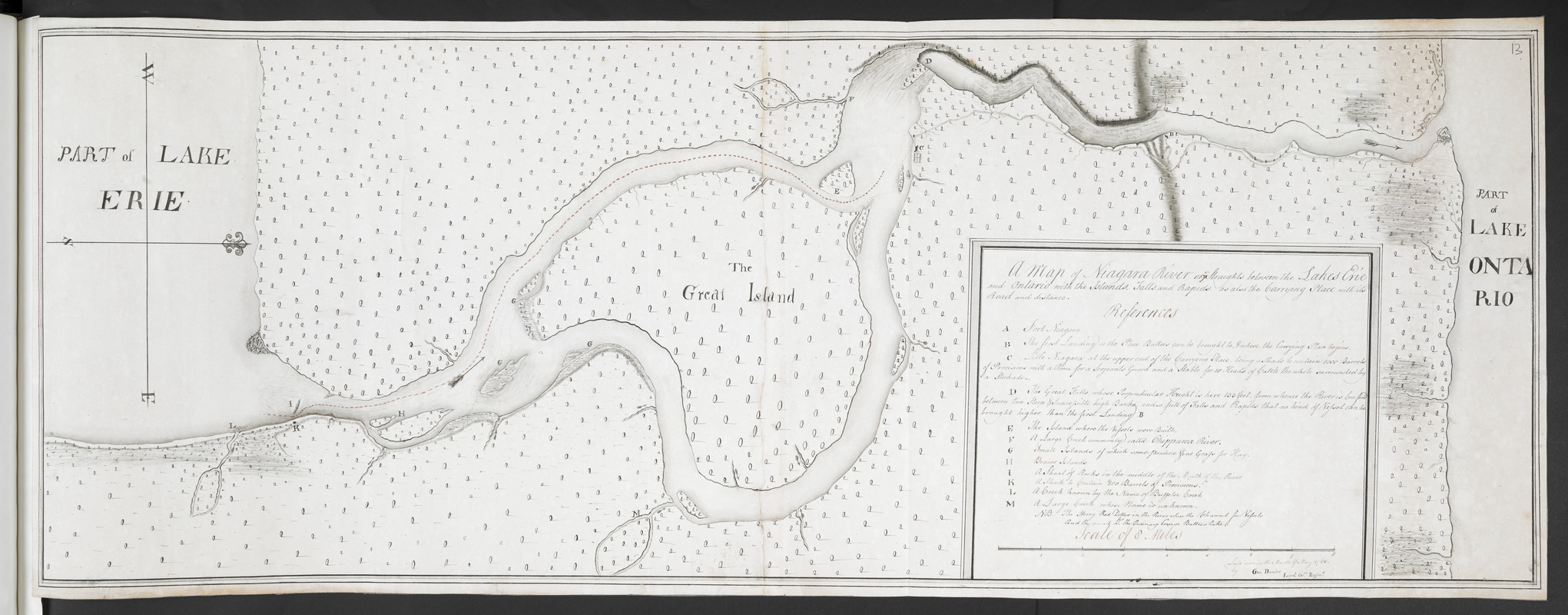
A Map of Niagara River or ye Straights between the Lakes Erie and Ontario with the Islands, Falls, and Rapids, as also the Carrying Place with its Road and distance
This map is also available in American Revolutionary Geographies Online (ARGO), a collections portal especially built for material relating to the American Revolutionary War Era. Visit ARGO to learn more about this item and explore the historical geography of North America in the late eighteenth century.
Item Information
- Title:
- A Map of Niagara River or ye Straights between the Lakes Erie and Ontario with the Islands, Falls, and Rapids, as also the Carrying Place with its Road and distance
- Cartographer:
- Demler, George
- Former owner:
- Amherst, Jeffery Amherst, Baron, 1717-1797
- Former owner:
- Royal United Services Institute for Defence and Security Studies
- Name on Item:
-
Lay'd down in the Month of May 1760 by Geo. Demler Lieu.t 60.th Regim.t.
- Date:
-
[1760]
- Format:
-
Maps/Atlases
- Location:
- British Library
- Collection (local):
-
British Library Collection
- Subjects:
-
Fortification--Niagara River (N.Y. and Ont.)--Maps, Manuscript--Early works to 1800
Niagara River (N.Y. and Ont.)--Maps, Manuscript--Early works to 1800
- Places:
-
Niagara (county)Old Fort Niagara
- Extent:
- 1 map on 2 sheets : joined, manuscript pen and ink in black and red ; 33 x 92 cm
- Terms of Use:
-
No known copyright restrictions.
This work is licensed for use under a Creative Commons Attribution Non-Commercial Share Alike License (CC BY-NC-SA).

- Publisher:
-
[Fort Niagara?] :
Lay'd down in the Month of May 1760 by Geo. Demler Lieu.t 60.th Regim.t,
- Scale:
-
Scale approximately 1:63,360
- Language:
-
English
- Catalog Record:
-
http://searcharchives.bl.uk/IAMS_VU2:IAMS040-001999738
- Notes:
-
Relief is shown by shading.
Oriented with north to the right of the map.
Shows the river navigation by means of dotted line in red ink.
Shows paths and roads for the overland route from "Little Niagara" to Fort Niagara.
Shows the title, lettered key (A-M) and scale bar ("Scale of 8 miles") in a simple surround at lower right.
Copy at Add Ms 57,708.13. Bound in R.U.S.I. Vol LXXIII. Comprises 2 sheets, joined. Shows manuscript addition of "13" in pencil at upper right. Laid on archival tissue. Green circular label to verso showing "15". White label to verso showing "DRAWER 27 SECTION 3". Blue label to verso showing "A 27/33A" and repeated in pencil. Shows "A 53" in pencil to verso. Paper watermark shows a fleur de lys within a shield with "LVG" beneath.
- Notes (date):
-
9999
This date is inferred.


