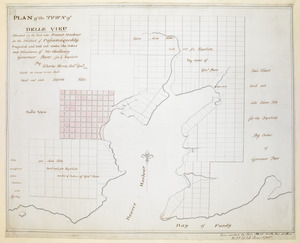
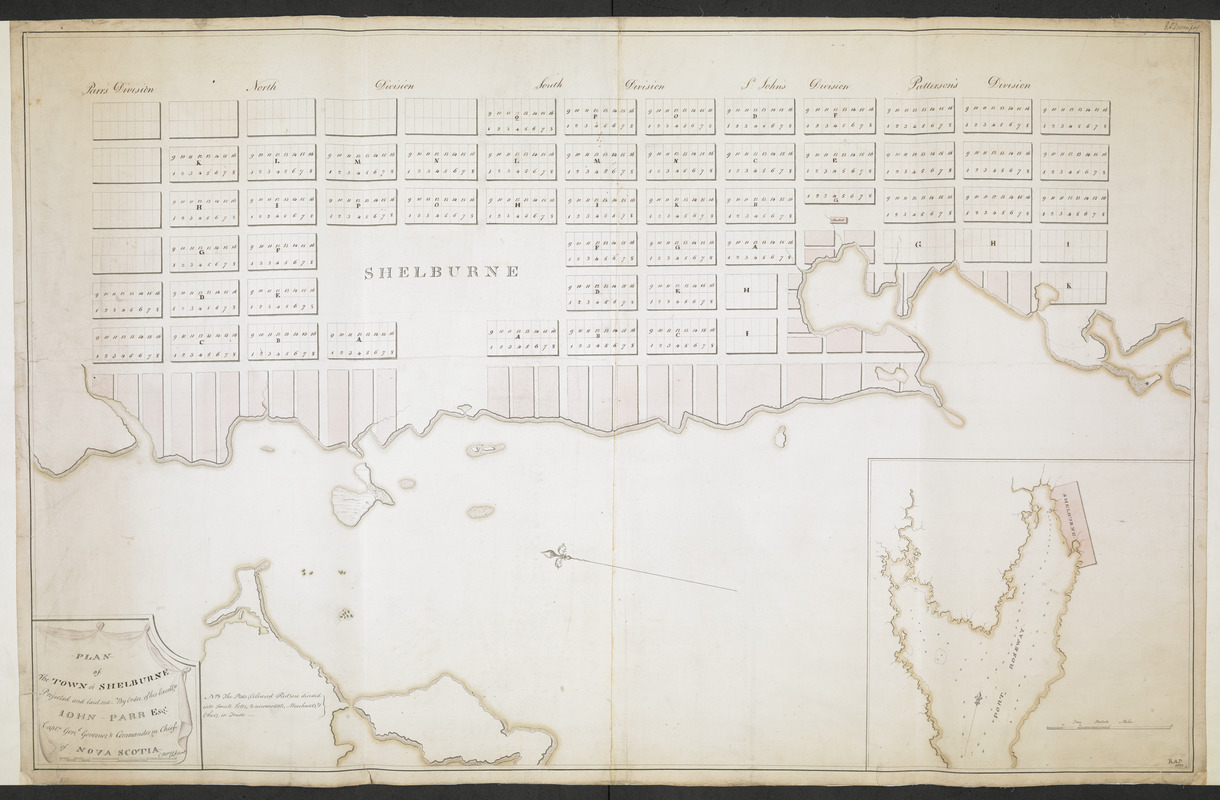
PLAN of The TOWN of SHELBURNE projected and laid out By Order of his Excell,y IOHN PARR Esqr Capt,n Gen,l Governor & Commander in Chief of NOVA SCOTA
This map is also available in American Revolutionary Geographies Online (ARGO), a collections portal especially built for material relating to the American Revolutionary War Era. Visit ARGO to learn more about this item and explore the historical geography of North America in the late eighteenth century.
Item Information
- Title:
- PLAN of The TOWN of SHELBURNE projected and laid out By Order of his Excell,y IOHN PARR Esqr Capt,n Gen,l Governor & Commander in Chief of NOVA SCOTA
- Cartographer:
- Morris, Charles, (Surveyor)
- Associated name:
- Parr, John, 1725-1791
- Signer:
- Davenport, R. A.
- Former owner:
- Royal United Services Institute for Defence and Security Studies
- Name on Item:
-
Morris Ch.f Surv.r.
- Date:
-
[ca. 1785]
- Format:
-
Maps/Atlases
- Location:
- British Library
- Collection (local):
-
British Library Collection
- Subjects:
-
United Empire loyalists--Maps, Manuscript--Early works to 1800
Shelburne (N.S.)--Maps, Manuscript--Early works to 1800
- Places:
-
CanadaShelburne
- Extent:
- 1 map on 2 sheets : joined, laid on linen, manuscript pen and ink with watercolour ; 64 x 101 cm
- Terms of Use:
-
No known copyright restrictions.
This work is licensed for use under a Creative Commons Attribution Non-Commercial Share Alike License (CC BY-NC-SA).

- Publisher:
-
[Shelburne] :
Morris Ch.f Surv.r.,
- Scale:
-
Scale not given
- Language:
-
English
- Catalog Record:
-
http://searcharchives.bl.uk/IAMS_VU2:IAMS040-001999733
- Notes:
-
Date from comparison with Maps K.Top.119.52 / Maps K.Top.119.53 / Maps K.Top.119.54. and with "General Plan of Land surveyed, laid out and granted to Loyal Emigrants and Disbanded Corps within the County of Shelburne in the Province of Nova Scotia. Done under the orders and directions of H.E. John Parr, Esq., by Charles Morris, Surv.-Genl. MS. 2 inches to 1 mile" held by The National Archives (see CO 700/NovaScotia57).
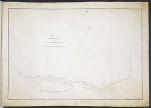
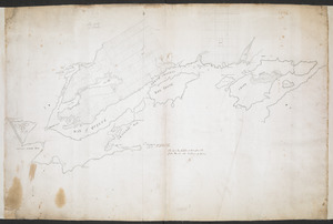
Relief shown pictorially.
Shows title in decorative cartouche at lower left including a scale bar (but units are not given).
Orients north to the left of the map.
Shows a note at lower left 2NB The Plats (Coloured Red) divided into Small Lotts, to accommodate, Merchants, & Others, in Trade".
Shows numbered plots within the town under the headings "Parr's Division", "North Division", "South Division", "St John's Division" and "Patterson's Division".
Inset at lower right with a map showing Shelburne within the wider environs of the harbour. Shows a scale of "Two Statute Miles" (scale approximately 1:29,000) and shows sounding depths.
Signed "R.A.D. 1820" at lower right and "R. A. Davenport" at upper right (a former owner? - compare Add Ms 57,702.1. and Add Ms 57,702.2.).
Copy at Add Ms 57,703.4. In a R.U.S.I. solander box numbered Vol LXVII. Map comprises 2 sheets joined and laid on linen. Manuscript addition of "Plan of Shelburne, Nova Scotia" in ink to verso. Laid on linen. Linen shows stamp of "ADD. MS. 57,703 (4)" in black ink. Green circular label to verso shows "33". White label to verso shows "DRAWER 28 SECTION 1". Blue label to verso shows "A 28/88". Additional annotation in pencil repeats shelfmark "57703-4".
- Notes (date):
-
9999