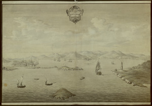
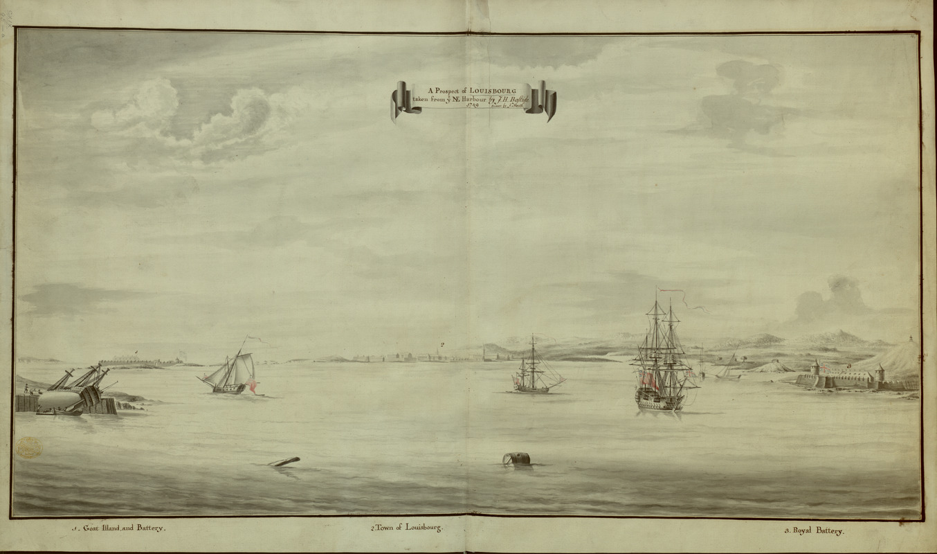
A Prospect of LOUISBOURG taken from ye NE Harbour
This map is also available in American Revolutionary Geographies Online (ARGO), a collections portal especially built for material relating to the American Revolutionary War Era. Visit ARGO to learn more about this item and explore the historical geography of North America in the late eighteenth century.
Item Information
- Title:
- A Prospect of LOUISBOURG taken from ye NE Harbour
- Description:
-
A view of the harbour at Louisbourg, probably after the Battle of Louisbourg; ships flying British flags; a capsized ship on the left-hand side; the Royal Battery flying the British flag on the right-hand side. Inscribed with title, artist and date in black in in the upper centre. The view is numbered '1' on the left and bears key in black ink below image 'Goat Illand and Battery'; '2' in the centre and bears key in black ink below image 'Town of Louisbourg'; '3' on the right and bears key in black ink below image 'Royal Battery'. Bears watermark IHS / I VILLEDARY = Ornamented Fleur de Lys / 4 / LVG.
- Artist:
- Bastide, John Henry, approximately 1700-1770
- Artist:
- Heath, Joseph, active 1749-1755
- Former owner:
- George, III, King of Great Britain, 1738-1820
- Donor:
- George, IV, King of Great Britain, 1762-1830
- Name on Item:
-
by J.H. Bastide, drawn by J. Heath.
- Date:
-
1749
- Format:
-
Drawings/Illustrations
Manuscripts
- Genre:
-
Views
- Location:
- British Library
- Collection (local):
-
British Library Collection
- Subjects:
-
Harbors--Nova Scotia--Louisbourg--Pictorial works--Early works to 1800
Louisbourg (N.S.)--Pictorial works--Early works to 1800
- Places:
-
CanadaLouisbourg
- Extent:
- 1 drawing : pen and black ink with monochrome, red and blue wash ; sheet 44.7 x 75.2 cm
- Terms of Use:
-
No known copyright restrictions.
This work is licensed for use under a Creative Commons Attribution Non-Commercial Share Alike License (CC BY-NC-SA).

- Language:
-
English
- Catalog Record:
-
http://explore.bl.uk/BLVU1:LSCOP-ALL:BLL01004987922
- Notes:
-
Titled ‘A drawn View of Louisbourg taken from the N.E. Harbour, by I.H. Bastide, 1749; drawn by I. Heath.’ in the Catalogue of Maps, Prints, Drawings, etc., forming the geographical and topographical collection attached to the Library of his late Majesty King George the third, etc, London, 1829.
Titled ‘A "Prospect of Louisbourg, taken from the N.E. Harbour, by J.H. Bastide, 1749; drawn by J. Heath:" 2 f. 5 in. x 1 f. 3 in.’ in the Catalogue of the manuscript maps, charts, and plans, and of the topographical drawings in the British Museum, London, 1844-1861.