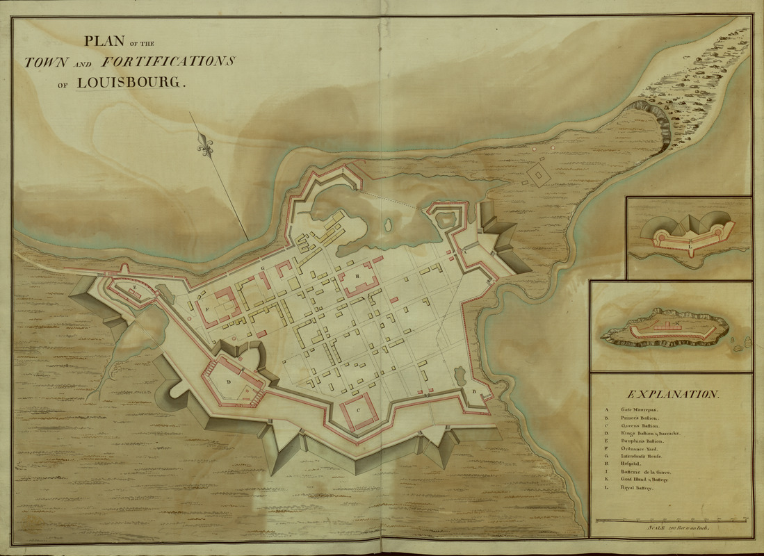
PLAN of the TOWN and FORTIFICATIONS of LOUISBOURG
This map is also available in American Revolutionary Geographies Online (ARGO), a collections portal especially built for material relating to the American Revolutionary War Era. Visit ARGO to learn more about this item and explore the historical geography of North America in the late eighteenth century.
Item Information
- Title:
- PLAN of the TOWN and FORTIFICATIONS of LOUISBOURG
- Former owner:
- George, III, King of Great Britain, 1738-1820
- Donor:
- George, IV, King of Great Britain, 1762-1830
- Cartographer:
- Bastide, John Henry, approximately 1700-1770
- Date:
-
1745
- Format:
-
Maps/Atlases
Manuscripts
- Location:
- British Library
- Collection (local):
-
British Library Collection
- Subjects:
-
Austrian Succession, War of, 1740-1748--Maps, manuscript--Early works to 1800
Military maps--Early works to 1800
United States--History--King George’s War, 1744-1748--Maps, manuscript--Early works to 1800
Louisbourg (N.S.)--History--Siege, 1745--Maps, Manuscript--Early works to 1800
Louisbourg (N.S.)--Maps, Manuscript--Early works to 1800
- Places:
-
CanadaLouisbourg
- Extent:
- 1 map : manuscript pen and ink with watercolour ; 48 x 68 cm
- Terms of Use:
-
No known copyright restrictions.
This work is licensed for use under a Creative Commons Attribution Non-Commercial Share Alike License (CC BY-NC-SA).

- Scale:
-
Scale 1:2,400
- Language:
-
English
- Catalog Record:
-
http://explore.bl.uk/BLVU1:LSCOP-ALL:BLL01016745994
- Notes:
-
Cartographer and place and date of production attributed on stylistic similarities with "A PLAN OF THE HARBOUR AND FORTIFICATIONS OF LOUISBOURG The Harbour Survey'd by Capt. Philip Durell. The Fortifications by Capt. Henry Bastide Anno 1745" (Map K.Top.119.89.) and on cartographic similarities with "Plan of the City and Fortress of LOUISBOURG Surrendered to his Britanick Majesty by Capitulation the 17 June 1745. to Lieut. Genl. Pepperel and Commodore Warren after 55 Days Blockade and 42 days open Trenches Drawn on the spot by J°n. Henry Bastide Engineer in Ordinary" (Maps K.Top.119.93.).
The lettered "EXPLANATION" (A-I) appears in a surround at lower right identifying places of note including the bastions and hospital.
Scale appears at lower right - "Scale 200 Feet to an Inch".
A compass point with ornamental fleur de lys orients north on the page.
Titled 'A drawn plan of the Town and Fortifications of Louisbourg' in the Catalogue of Maps, Prints, Drawings, etc., forming the geographical and topographical collection attached to the Library of his late Majesty King George the third, etc., London, 1829.
Titled 'A colored "Plan of the Town and Fortifications of Louisbourg;" drawn on a scale of 200 feet to an inch: 2 f. 3 in. x 1 f. 6 in.' in the Catalogue of the manuscript maps, charts, and plans, and of the topographical drawings in the British Museum.

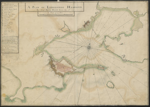
![[An outline plan of the harbour and fortifications of Louisbourg]](https://bpldcassets.blob.core.windows.net/derivatives/images/commonwealth:hx11z5128/image_thumbnail_300.jpg)