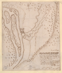
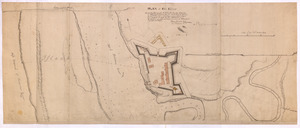
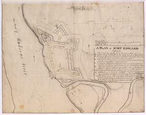
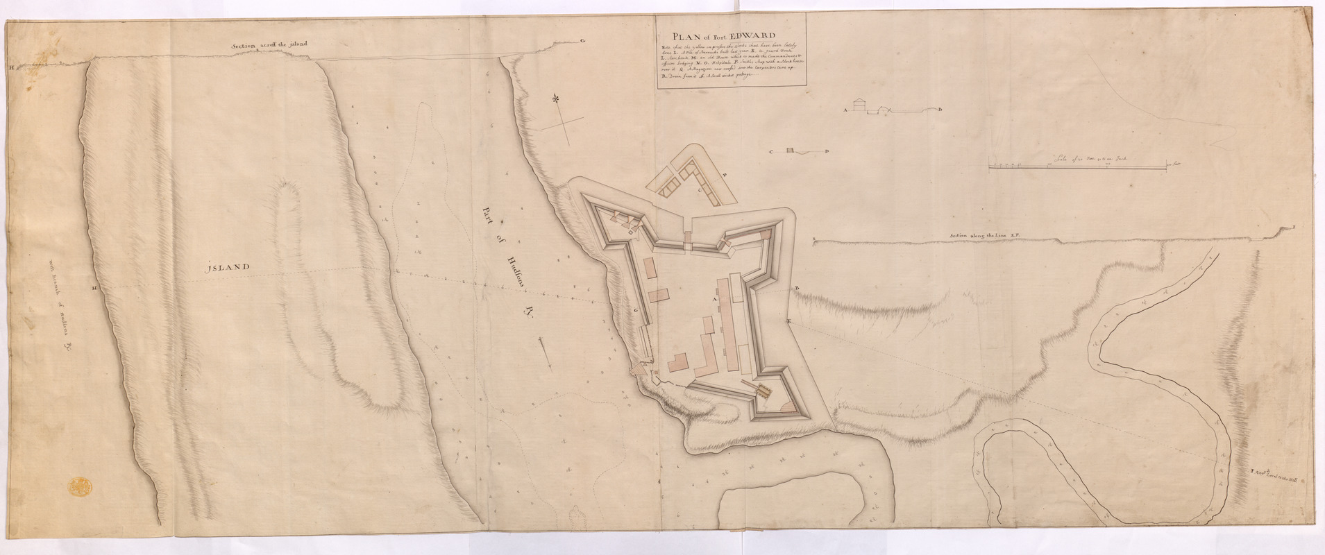
PLAN of Fort EDWARD
This map is also available in American Revolutionary Geographies Online (ARGO), a collections portal especially built for material relating to the American Revolutionary War Era. Visit ARGO to learn more about this item and explore the historical geography of North America in the late eighteenth century.
Item Information
- Title:
- PLAN of Fort EDWARD
- Former owner:
- George, III, King of Great Britain, 1738-1820
- Donor:
- George, IV, King of Great Britain, 1762-1830
- Cartographer:
- Bartman, George
- Cartographer:
- Gordon, Harry, -1787
- Date:
-
1755
- Format:
-
Maps/Atlases
Manuscripts
- Location:
- British Library
- Collection (local):
-
British Library Collection
- Subjects:
-
Fortification--New York (State)--Fort Edward--Maps, Manuscript--Early works to 1800
Military art and science--New York (State)--Fort Edward--Maps, Manuscript--Early works to 1800
Fort Edward (N.Y.)--Maps, Manuscript--Early works to 1800
United States--History--French and Indian War, 1754-1763--Maps, Manuscript--Early works to 1800
- Places:
-
Washington (county)Fort Edward
- Extent:
- 1 map on 2 sheets : joined, manuscript pen and ink with watercolour ; 46 x 116 cm
- Terms of Use:
-
No known copyright restrictions.
This work is licensed for use under a Creative Commons Attribution Non-Commercial Share Alike License (CC BY-NC-SA).

- Scale:
-
Scale approximately 1:600
- Language:
-
English
- Catalog Record:
-
http://explore.bl.uk/BLVU1:LSCOP-ALL:BLL01016739360
- Notes:
-
Previous British Library cataloguing attributes a date of about 1755.
Relief is shown by shading.
Shows sounding depths in the Hudson River.
Shows part of present-day Rogers Island.
With a scale of 400 feet, 50 to an inch.
Copied from Harry Gordon and George Bateman's (signed) map of the same (Maps K.Top.121.60.) - although this map appears to be in a different hand.
The title appears centrally at the top of the map with lettered references below. A note reads that the yellow identifies "the Works that have been lately done".
Includes three inset cross sections beneath the title of views through the fort.
Titled "A drawn Plan of Fort Edward" in the Catalogue of Maps, Prints, Drawings, etc., forming the geographical and topographical collection attached to the Library of his late Majesty King George the third, etc., London, 1829.
Titled "Another copy of the preceding, on the same scale and size" where the preceding is 'A colored "plan of Fort Edward;" drawn about the end of 1755, by Harry Gordon and Geo. Bartman, engineers; on a scale of 50 feet to an inch: 3 f. 9 in. x 1 f. 6 in.' in the Catalogue of the manuscript maps, charts, and plans, and of the topographical drawings in the British Museum.