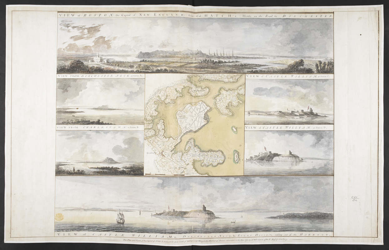
VIEW of BOSTON the Capital of NEW ENGLAND from Col. HATCH's House on the Road to DORCHESTER = VIEW FROM DORCHESTER NECK = VIEW of CASTLE WILLIAM at Station C = VIEW FROM CHARLESTOWN = VIEW OF CASTLE WILLIAM at Station D = VIEW of CASTLE WILLIAM
This map is also available in American Revolutionary Geographies Online (ARGO), a collections portal especially built for material relating to the American Revolutionary War Era. Visit ARGO to learn more about this item and explore the historical geography of North America in the late eighteenth century.
Item Information
- Title:
- VIEW of BOSTON the Capital of NEW ENGLAND from Col. HATCH's House on the Road to DORCHESTER = VIEW FROM DORCHESTER NECK = VIEW of CASTLE WILLIAM at Station C = VIEW FROM CHARLESTOWN = VIEW OF CASTLE WILLIAM at Station D = VIEW of CASTLE WILLIAM
- Title (alt.):
-
VIEW FROM DORCHESTER NECK
VIEW of CASTLE WILLIAM at Station C
VIEW FROM CHARLESTOWN
VIEW OF CASTLE WILLIAM at Station D
VIEW of CASTLE WILLIAM
- Description:
-
We Are One: During the British occupation of Boston, Lieutenant William Pierie of the Royal Artillery drew this map of the city and the surrounding landscapes. Surveys like these provided the British with information about the geography of North America. Engravings of Pierie’s scenes appeared in The Atlantic Neptune, a maritime atlas used by the British Navy during the Revolutionary War. Pierie depicted geographical features that proved strategically important during the siege of Boston. George Washington’s soldiers, for example, would build fortifications on Dorchester Heights that helped force the British to evacuate.
- Artist:
- Pierie, William
- Former owner:
- George, III, King of Great Britain, 1738-1820
- Donor:
- George, IV, King of Great Britain, 1762-1830
- Name on Item:
-
This Plan and Views of the Capital of NEW ENGLAND and Castle of William and Mary in the Harbour of Boston, were taken in the Year 1773, by Lt. Wm. Pierie of the Rl. Reg.t of Artillery.
- Date:
-
1773
- Format:
-
Drawings/Illustrations
Manuscripts
- Genre:
-
Views
- Location:
- British Library
- Collection (local):
-
British Library Collection
- Subjects:
-
Landscapes--Massachusetts--Boston--Pictorial works--Early works to 1800
Boston (Mass.)--Pictorial works--Early works to 1800
- Places:
-
Suffolk (county)Boston
- Extent:
- 1 drawing : watercolour ; sheet 55.5 x 88.6 cm
- Terms of Use:
-
No known copyright restrictions.
This work is licensed for use under a Creative Commons Attribution Non-Commercial Share Alike License (CC BY-NC-SA).

- Scale:
-
Scale 1:36,205
- Language:
-
English
- Catalog Record:
-
http://explore.bl.uk/BLVU1:LSCOP-ALL:BLL01004987805
- Notes:
-
Plan of Boston and its environs surrounded by six views of the areas represented in the map, including Castle William (Fort Independence).||Titled ‘A drawn Plan and six Views of the Town and Environs of Boston: by Lieut. Wm. Pierie, 1773’ in the Catalogue of the Maps, Prints, Drawings, etc., forming the geographical and topographical collection attached to the Library of his late Majesty King George the third, etc., London, 1829.||Titled 'A colored plan of the town and environs of Boston, the capital of new England; drawn by Lieut. Wm. Pierie, of the Royal Regiment of Artillery, in 1773, on a scale of 1 3/4 inch to a mile; with six colored views: viz. i. Boston from Col. Hatch's house, on the road to Dorchester;--ii. View from Dorchester neck;--iii. View from Charlestown;--iv. v. vi. Three views of Castle William' in the Catalogue of the manuscript maps, charts, and plans, and of the topographical drawings in the British Museum, London, 1844-1861.
- Notes (exhibitions):
-
Exhibited: "We Are One: Mapping America's Road from Revolution to Independence" organized by the Norman B. Leventhal Map Center at the Boston Public Library, 2015.

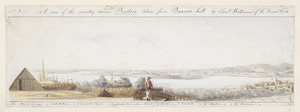
![[View of the country round Boston taken from Beacon hill]](https://bpldcassets.blob.core.windows.net/derivatives/images/commonwealth:6108vv93v/image_thumbnail_300.jpg)
![[View of the country round Boston taken from Beacon hill]](https://bpldcassets.blob.core.windows.net/derivatives/images/commonwealth:6108vv97z/image_thumbnail_300.jpg)
![[View of the country round Boston taken from Beacon hill]](https://bpldcassets.blob.core.windows.net/derivatives/images/commonwealth:6108vv95d/image_thumbnail_300.jpg)
