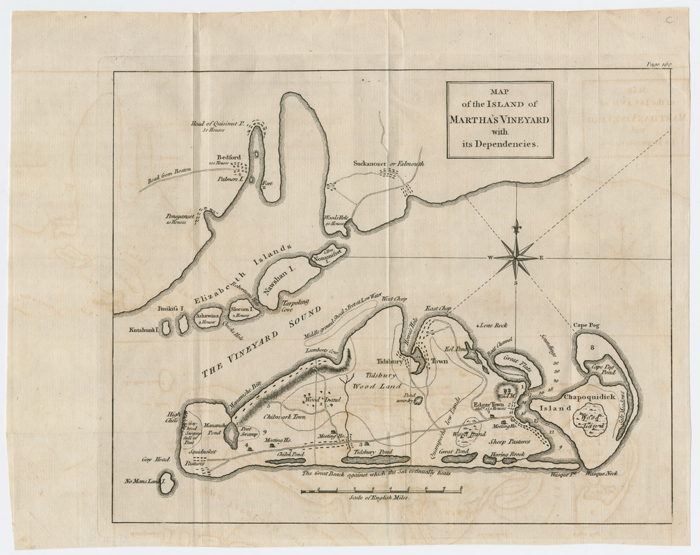
Map of the island of Martha's Vineyard with its dependencies
This map is also available in American Revolutionary Geographies Online (ARGO), a collections portal especially built for material relating to the American Revolutionary War Era. Visit ARGO to learn more about this item and explore the historical geography of North America in the late eighteenth century.
Item Information
- Title:
- Map of the island of Martha's Vineyard with its dependencies
- Creator:
- St. John de Crèvecoeur, J. Hector, 1735-1813
- Date:
-
[1782]
- Format:
-
Maps/Atlases
- Location:
- Massachusetts Historical Society
- Collection (local):
-
Massachusetts Historical Society Collection
- Subjects:
-
Martha's Vineyard (Mass.)--Maps--Early works to 1800
- Places:
-
Dukes (county)Martha's Vineyard (island)
- Extent:
- 1 map ; 20 x 26 cm.
- Terms of Use:
-
No known copyright restrictions.
This work is licensed for use under a Creative Commons Attribution Non-Commercial Share Alike License (CC BY-NC-SA).

- Scale:
-
Scale [ca. 1:190,080]
- Language:
-
English
- Catalog Record:
-
http://balthazaar.masshist.org/cgi-bin/Pwebrecon.cgi?DB=local&BBID=186529
- Notes:
-
Relief shown by hachures.
"Page 160."
From the author's Letters from an American farmer ... 1782.
- Notes (date):
-
This date is inferred.

![[Chart of Nantucket Island and the eastern half of Martha's Vineyard]](https://bpldcassets.blob.core.windows.net/derivatives/images/commonwealth:7h149z54k/image_thumbnail_300.jpg)


