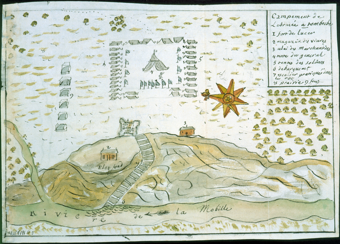
Campement de l'armée à Tombecbe
This map is also available in American Revolutionary Geographies Online (ARGO), a collections portal especially built for material relating to the American Revolutionary War Era. Visit ARGO to learn more about this item and explore the historical geography of North America in the late eighteenth century.
Item Information
- Title:
- Campement de l'armée à Tombecbe
- Description:
-
Map of Fort Confederation (also known as Fort Tombécbee, Fort Tombigbee, and Fort York) on the Tombigbee River near the later site of Epes in Sumter County, Alabama; originally built by the French as a Choctaw Indian trading post. Details the 1736 occupation by French and Choctaw forces during their campaign against Chickasaw Indians allied with the English. Keyed to 9 references.
- Creator:
- Dumont de Montigny
- Date:
-
[1747]
- Format:
-
Maps/Atlases
Manuscripts
- Location:
- Newberry Library
- Collection (local):
-
Louis C. Karpinski Map Collection
- Subjects:
-
Choctaw Indians--Wars--Maps--Early works to 1800
Chickasaw Indians--Wars--Maps--Early works to 1800
Indians of North America--Warfare--Alabama--Maps--Early works to 1800
Indians of North America--Wars--1600-1750--Maps--Early works to 1800
Fortification--Alabama--Fort Confederation--Maps--Early works to 1800
Manuscript maps--Early works to 1800
Fort Confederation (Ala.)--Maps--Early works to 1800
Sumter County (Ala.)--Maps--Early works to 1800
- Places:
-
Fort Tombecbe (historical)
- Extent:
- 1 ms. map : hand col. ; 177 x 268 mm.
- Terms of Use:
-
No known copyright restrictions.
Contact host institution for more information.
- Scale:
-
Scale not given
- Language:
-
French
- Catalog Record:
-
https://i-share-nby.primo.exlibrisgroup.com/permalink/01CARLI_NBY/i5mcb2/alma991477278805867
- Notes:
-
Relief shown pictorially.
Oriented with north at left.
Note on verso: No. 10, page 257.
Pen-and-ink and watercolor (green, yellow, gray, brown).
No. 10 of 23 maps and drawings detached and bound together, from: Dumont de Montigny. Memoire de Lxx Dxx Officiere Ingenieur, contenant les evenemens qui se sont passés à la Louisiane depuis 1715 jusqu'a present [1747]
Ms. memoir adapted by Jean Baptiste Le Mascrier and published as Dumont de Montigny, Mémoires historiques sur la Louisiane. Paris: C.J.B. Bauche, 1753.
- Notes (date):
-
This date is inferred.
- Call #:
-
Ayer MS 257 map 10 (NLO)
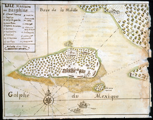
![[Campement] de l'armée franc̦oise [devant u]n village des ennemis, les Chicachas le 26 [de mais] 1736](https://bpldcassets.blob.core.windows.net/derivatives/images/commonwealth:z603vn65v/image_thumbnail_300.jpg)