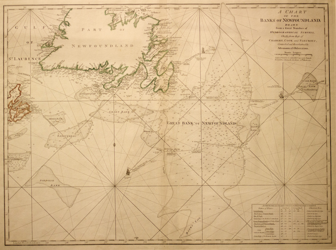
A chart of the Banks of Newfoundland
This map is also available in American Revolutionary Geographies Online (ARGO), a collections portal especially built for material relating to the American Revolutionary War Era. Visit ARGO to learn more about this item and explore the historical geography of North America in the late eighteenth century.
Item Information
- Title:
- A chart of the Banks of Newfoundland
- Creator:
- Chabert, Joseph Bernard, marquis de, 1724-1805
- Contributor:
- Cook, James, 1728-1779
- Contributor:
- Fleurieu, C. P. Claret (Charles Pierre Claret), comte de, 1738-1810
- Publisher:
- Robert Sayer and John Bennett (Firm)
- Name on Item:
-
Drawn from a great number of hydrographical surveys, chiefly from those of Chabert, Cook, and Fleurieu, connected and ascertained by astronomical observations.
- Date:
-
1775
- Format:
-
Maps/Atlases
- Location:
- Boston Athenaeum
- Collection (local):
-
Cartographic Collection
- Subjects:
-
Nautical charts--Grand Banks of Newfoundland--Early works to 1800
Grand Banks of Newfoundland--Maps--Early works to 1800
- Places:
-
Grand Banks of Newfoundland
- Extent:
- col. map 50 x 67 cm.
- Terms of Use:
-
No known copyright restrictions.
This work is licensed for use under a Creative Commons Attribution Non-Commercial Share Alike License (CC BY-NC-SA).

- Publisher:
-
London :
Printed for & sold by Robt. Sayer & Jno. Bennett
- Scale:
-
Scale ca. 1:2,100,000
- Language:
-
English
- Catalog Record:
-
http://catalog.bostonathenaeum.org/vwebv/holdingsInfo?bibId=472700
- Notes:
-
Hand colored.
Depths shown by soundings.
Prime meridian: London.
Includes chart "Astronomical observations on which this chart is grounded."
- LCCN:
-
73694739


