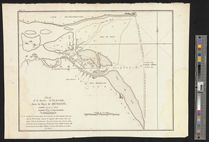
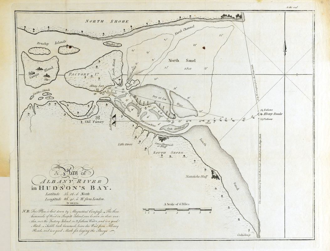
A plan of Albany River in Hudson's Bay : latitude 50⁰ 12' 0" North, longitude 82⁰ 40' 0" W. from London
This map is also available in American Revolutionary Geographies Online (ARGO), a collections portal especially built for material relating to the American Revolutionary War Era. Visit ARGO to learn more about this item and explore the historical geography of North America in the late eighteenth century.
Item Information
- Title:
- A plan of Albany River in Hudson's Bay : latitude 50⁰ 12' 0" North, longitude 82⁰ 40' 0" W. from London
- Creator:
- Hearne, Samuel, 1745-1792
- Contributor:
- Neele, Samuel John, 1758-1824
- Name on Item:
-
by S.H., 1774.
- Date:
-
[1795?]
- Format:
-
Maps/Atlases
- Location:
- Boston Athenaeum
- Collection (local):
-
Cartographic Collection
- Subjects:
-
Albany River (Ont.)--Maps
- Places:
-
CanadaAlbany River
- Extent:
- 1 map ; 27 x 34 cm.
- Terms of Use:
-
No known copyright restrictions.
This work is licensed for use under a Creative Commons Attribution Non-Commercial Share Alike License (CC BY-NC-SA).

- Publisher:
-
[S.l.] :
[s.n.]
- Scale:
-
Scale [ca. 1:122,000]
- Language:
-
English
- Catalog Record:
-
http://catalog.bostonathenaeum.org/vwebv/holdingsInfo?bibId=452893
- Notes:
-
Relief shown by soundings.
Binder's instructions outside border at top right: "At the end."
Variant state on different paper published: London : Cadell & Davies, Jany. 1st, 1795. This variant credits S.I. Neele, sculpt in lower right corner and is identified as plate VI in upper left corner. Issued in Hearne, Samuel. A journey from Prince of Wales's Fort in Hudson's Bay, to the Northern Ocean. London : Printed for A. Strahan and T. Cadell ..., 1795.