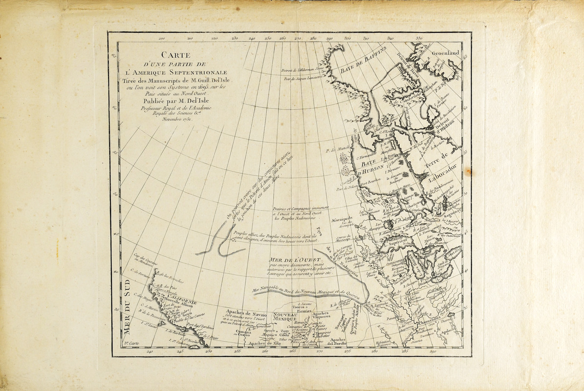
Carte d'une partie de l'Amérique Septentrionale
This map is also available in American Revolutionary Geographies Online (ARGO), a collections portal especially built for material relating to the American Revolutionary War Era. Visit ARGO to learn more about this item and explore the historical geography of North America in the late eighteenth century.
Item Information
- Title:
- Carte d'une partie de l'Amérique Septentrionale
- Creator:
- L'Isle, Guillaume de, 1675-1726
- Publisher:
- L'Isle, Joseph Nicolas de, 1688-1768
- Contributor:
- L'Isle, Joseph Nicolas de, 1688-1768
- Name on Item:
-
tirée des manuscripts de M. Guill. De l'Isle ou l'on voit son systeme en 1695 sur les pais situés au nord ouest.
- Date:
-
1752
- Format:
-
Maps/Atlases
- Location:
- Boston Athenaeum
- Collection (local):
-
Cartographic Collection
- Subjects:
-
North America--Maps--Early works to 1800
- Places:
-
North America (area)
- Extent:
- 1 map ; 25 x 27 cm.
- Terms of Use:
-
No known copyright restrictions.
This work is licensed for use under a Creative Commons Attribution Non-Commercial Share Alike License (CC BY-NC-SA).

- Publisher:
-
[Paris] :
Publiée par M. De l'Isle professeur royal et de l'Académie Royale des Sciences &a
- Scale:
-
Scale [ca. 1:20,000,000]
- Language:
-
French
- Catalog Record:
-
http://catalog.bostonathenaeum.org/vwebv/holdingsInfo?bibId=442349
- Notes:
-
At lower left, within neat line: 3e "carte."
- Notes (date):
-
Novembre 1752


![[A map of the east coast of America from Newfoundland to the Bay of Honduras]](https://bpldcassets.blob.core.windows.net/derivatives/images/commonwealth:hx11z584h/image_thumbnail_300.jpg)


