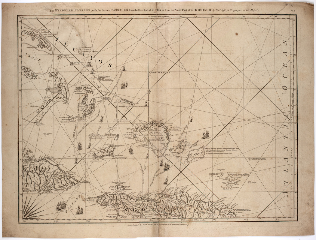
The Windward Passage, with the several passages from the east end of Cuba : & from the north part of St. Domingo
This map is also available in American Revolutionary Geographies Online (ARGO), a collections portal especially built for material relating to the American Revolutionary War Era. Visit ARGO to learn more about this item and explore the historical geography of North America in the late eighteenth century.
Item Information
- Title:
- The Windward Passage, with the several passages from the east end of Cuba : & from the north part of St. Domingo
- Description:
-
Subject: Map of the Windward Passage in the Caribbean, showing parts of Cuba, the Dominican Republic and other islands.
- Creator:
- Jefferys, Thomas, -1771
- Publisher:
- Laurie & Whittle
- Name on Item:
-
by Thos. Jefferys geographer to His Majesty.
- Date:
-
1794
- Format:
-
Maps/Atlases
- Location:
- American Antiquarian Society
- Collection (local):
-
American Antiquarian Society Collection
- Subjects:
-
Windward Passage--Maps
West Indies--Maps
- Places:
-
Windward Passage
West Indies
- Extent:
- 1 map : engraving ; 00 x 00 cm.
- Terms of Use:
-
Public Domain/No known restrictions on use. Contact host institution to download image.
Contact host institution for more information.
- Publisher:
-
London :
Published by Laurie & Whittle, no. 53 Fleet Street as the act directs
- Scale:
-
Scale not given
- Language:
-
English
- Catalog Record:
-
http://catalog.mwa.org/vwebv/holdingsInfo?bibId=481920
- Notes:
-
Prime meridian: London and Ferro.
Relief shown pictorially. Depths shown by soundings.
In upper right corner: Ch. 8.
From Jefferys, T. Complete pilot for the West-Indies, London, 1794-1805.


