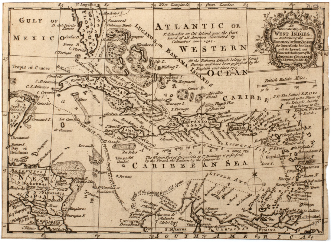
An accurate map of the West Indies, : containing the Bahama & Carribe islands, the Great & Little Antilles, with the Leward and Windward Islands & part of the American continent
This map is also available in American Revolutionary Geographies Online (ARGO), a collections portal especially built for material relating to the American Revolutionary War Era. Visit ARGO to learn more about this item and explore the historical geography of North America in the late eighteenth century.
Item Information
- Title:
- An accurate map of the West Indies, : containing the Bahama & Carribe islands, the Great & Little Antilles, with the Leward and Windward Islands & part of the American continent
- Title (uniform):
-
General magazine of arts and sciences
- Description:
-
Subject: Map of the Caribbean Islands, with a portion of Florida and Central America seen.
- Creator:
- Bowen, Emanuel, -1767
- Name on Item:
-
By E. Bowen geog. to His Maj.
- Date:
-
[1758]
- Format:
-
Maps/Atlases
- Location:
- American Antiquarian Society
- Collection (local):
-
American Antiquarian Society Collection
- Subjects:
-
West Indies--Maps
Caribbean Area--Maps
- Places:
-
West Indies
Caribbean Sea
- Extent:
- 1 map : engraving ; 19 x 26 cm.
- Terms of Use:
-
Public Domain/No known restrictions on use. Contact host institution to download image.
Contact host institution for more information.
- Publisher:
-
London :
[s.n.]
- Scale:
-
Scale [ca. 1:12,750,000]
- Language:
-
English
- Catalog Record:
-
http://catalog.mwa.org/vwebv/holdingsInfo?bibId=482486
- Notes:
-
Relief shown pictorially.
From The General magazine of arts and sciences. 1758.
- Notes (date):
-
This date is inferred.


