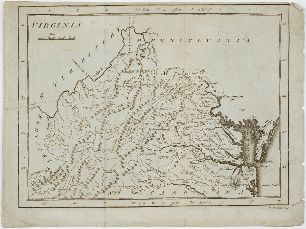
Virginia
This map is also available in American Revolutionary Geographies Online (ARGO), a collections portal especially built for material relating to the American Revolutionary War Era. Visit ARGO to learn more about this item and explore the historical geography of North America in the late eighteenth century.
Item Information
- Title:
- Virginia
- Description:
-
Subject: Map of the state of Virginia.
- Engraver:
- Barker, W. (William), active 1795-1803
- Publisher:
- M. Carey (Firm)
- Name on Item:
-
W. Barker sculp.
- Date:
-
[1796]
- Format:
-
Maps/Atlases
- Location:
- American Antiquarian Society
- Collection (local):
-
American Antiquarian Society Collection
- Subjects:
-
Virginia--Maps
- Places:
-
Virginia
- Extent:
- 1 map : engraving ; 15 x 20 cm., on sheet 17 x 23 cm.
- Terms of Use:
-
Public Domain/No known restrictions on use. Contact host institution to download image.
Contact host institution for more information.
- Publisher:
-
Philadelphia :
Mathew Carey
- Scale:
-
Scale [ca. 1:1,700,000]
- Language:
-
English
- Catalog Record:
-
http://catalog.mwa.org/vwebv/holdingsInfo?bibId=504478
- Notes:
-
Prime meridian: London and Philadelphia.
Relief shown pictorially.
From Carey, M. Carey's American pocket atlas, Philadelphia, 1796.
- Notes (date):
-
This date is inferred.


