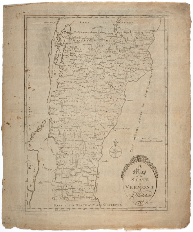
A map of the state of Vermont
This map is also available in American Revolutionary Geographies Online (ARGO), a collections portal especially built for material relating to the American Revolutionary War Era. Visit ARGO to learn more about this item and explore the historical geography of North America in the late eighteenth century.
Item Information
- Title:
- A map of the state of Vermont
- Description:
-
Subject: Map of the state of Vermont.
- Creator:
- Whitelaw, James, 1748-1829
- Engraver:
- Callender, Benjamin, 1773-1856
- Former owner:
- New England Historic Genealogical Society
- Name on Item:
-
by J. Whitelaw. 1793. ; Callender sct. Boston.
- Date:
-
[1793]
- Format:
-
Maps/Atlases
- Location:
- American Antiquarian Society
- Collection (local):
-
American Antiquarian Society Collection
- Subjects:
-
Vermont--Maps
- Places:
-
Vermont
- Extent:
- 1 map : engraving ; 36 x 26 cm., on sheet 42 x 35 cm.
- Terms of Use:
-
Public Domain/No known restrictions on use. Contact host institution to download image.
Contact host institution for more information.
- Publisher:
-
Boston? :
[s.n.]
- Scale:
-
Scale [ca. 1:1,013,760]
- Language:
-
English
- Catalog Record:
-
http://catalog.mwa.org/vwebv/holdingsInfo?bibId=462431
- Notes:
-
Prime meridian: Washington and London.
Relief shown by hachures.
- Notes (date):
-
This date is inferred.


