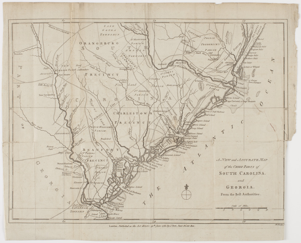
A New and accurate map of the chief parts of South Carolina, and Georgia
This map is also available in American Revolutionary Geographies Online (ARGO), a collections portal especially built for material relating to the American Revolutionary War Era. Visit ARGO to learn more about this item and explore the historical geography of North America in the late eighteenth century.
Item Information
- Title:
- A New and accurate map of the chief parts of South Carolina, and Georgia
- Description:
-
Subject: Map of South Carolina and part of Georgia, showing the land divided into precincts, townships and parishes.
- Publisher:
- Bew, John, -1793
- Engraver:
- Lodge, John
- Name on Item:
-
Jno. Lodge sculp.
- Date:
-
[1780]
- Format:
-
Maps/Atlases
- Location:
- American Antiquarian Society
- Collection (local):
-
American Antiquarian Society Collection
- Subjects:
-
South Carolina--Maps
Georgia--Maps
- Places:
-
Georgia
South Carolina
- Extent:
- 1 map : engraving ; 28 x 38 cm., on sheet 32 x 40 cm.
- Terms of Use:
-
Public Domain/No known restrictions on use. Contact host institution to download image.
Contact host institution for more information.
- Publisher:
-
London :
Published as the Act directs 30th June 1780, by J. Bew, Pater-Noster Row.
- Scale:
-
Scale [ca. 1:697,000]
- Language:
-
English
- Catalog Record:
-
http://catalog.mwa.org/vwebv/holdingsInfo?bibId=488810
- Notes (date):
-
This date is inferred.