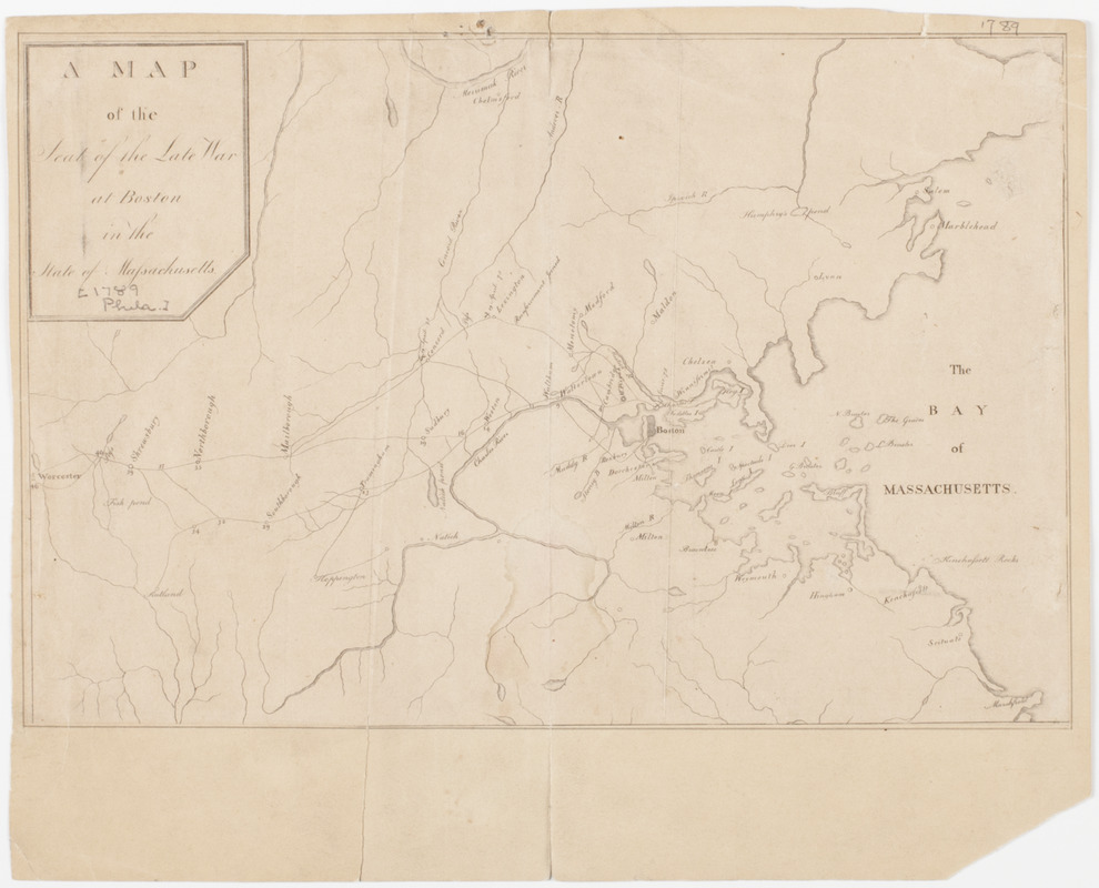
A Map of the seat of the late war at Boston in the state of Massachusetts
This map is also available in American Revolutionary Geographies Online (ARGO), a collections portal especially built for material relating to the American Revolutionary War Era. Visit ARGO to learn more about this item and explore the historical geography of North America in the late eighteenth century.
Item Information
- Title:
- A Map of the seat of the late war at Boston in the state of Massachusetts
- Title (uniform):
-
Columbian magazine, or, Monthly miscellany (Philadelphia, Pa.)
- Description:
-
Subject: Map of part of the state of Massachusetts extending from Chelmsford and Marblehead to the north, down to Marshfield to the south, and west to Worcester. The battles which took place in Lexington, Concord and Boston are marked.
- Engraver:
- Trenchard, James, 1747-
- Date:
-
[1789]
- Format:
-
Maps/Atlases
- Location:
- American Antiquarian Society
- Collection (local):
-
American Antiquarian Society Collection
- Subjects:
-
Massachusetts--Maps
United States--History--Revolution, 1775-1783--Maps
- Places:
-
Massachusetts
- Extent:
- 1 map ; 18 x 27 cm., on sheet 22 x 28 cm.
- Terms of Use:
-
Public Domain/No known restrictions on use. Contact host institution to download image.
Contact host institution for more information.
- Publisher:
-
Philadelphia :
[s.n.]
- Scale:
-
Scale not given
- Language:
-
English
- Catalog Record:
-
http://catalog.mwa.org/vwebv/holdingsInfo?bibId=476388
- Notes:
-
From the July, 1789 issue of the Columbian magazine, Philadelphia.
Probably engraved by James Trenchard. See Stauffer, D. American engravers, 1907, no. 3286.
- Notes (date):
-
This date is inferred.

![[Map of the towns of Western Massachusetts]](https://bpldcassets.blob.core.windows.net/derivatives/images/commonwealth:6108vv02d/image_thumbnail_300.jpg)


