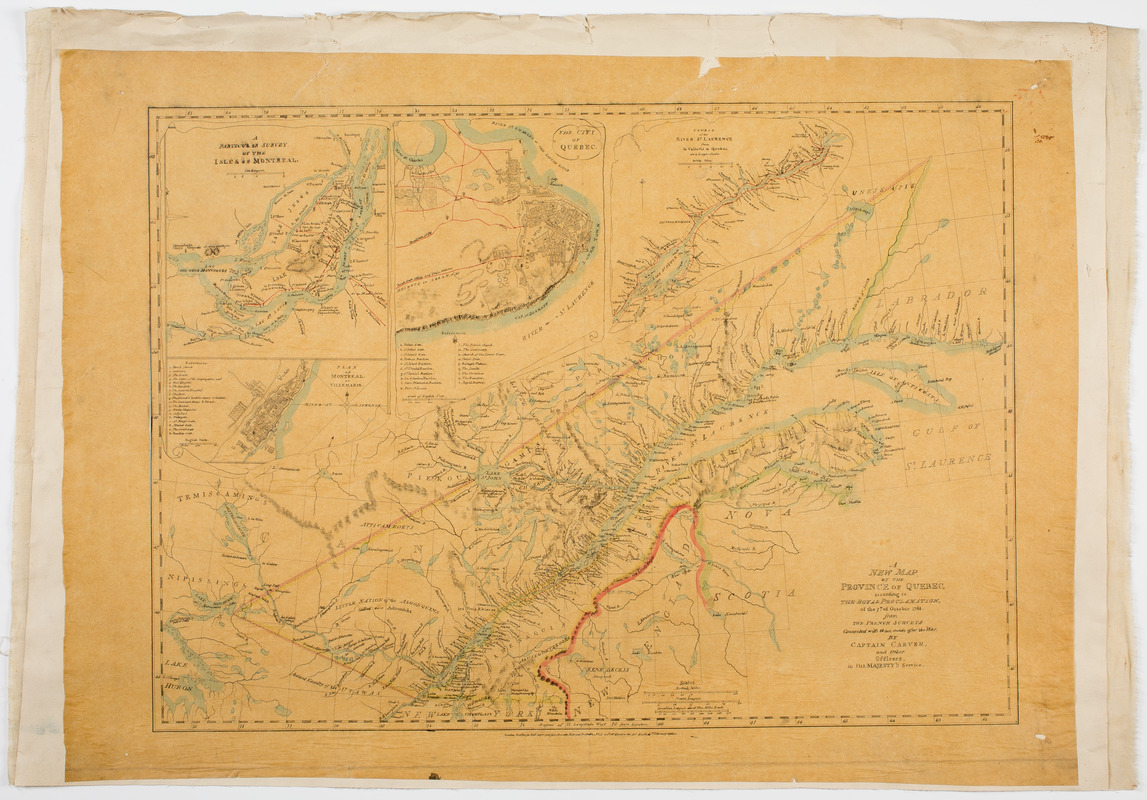
A new map of the province of Quebec, : according to the Royal proclamation, of the 7th of October 1763
This map is also available in American Revolutionary Geographies Online (ARGO), a collections portal especially built for material relating to the American Revolutionary War Era. Visit ARGO to learn more about this item and explore the historical geography of North America in the late eighteenth century.
Item Information
- Title:
- A new map of the province of Quebec, : according to the Royal proclamation, of the 7th of October 1763
- Description:
-
Subject: Map tracing of the province of Quebec along the Saint Lawrence River. Includes four inset maps shown using trompe l'oeil. At lower right is cartouche showing a wooded scene with a waterfall and pond.
- Creator:
- Carver, Jonathan, 1710-1780
- Name on Item:
-
From the French surveys connected with those made after the war, by Captain Carver, and other officers, in His Majesty's service.
- Date:
-
1776
- Format:
-
Maps/Atlases
Manuscripts
- Location:
- American Antiquarian Society
- Collection (local):
-
American Antiquarian Society Collection
- Subjects:
-
Québec (Province)--Maps
Québec (Québec)--Maps
Montréal (Québec)--Maps
Saint Lawrence River--Maps
- Places:
-
CanadaMontreal
CanadaQuébec
Saint Lawrence River
- Extent:
- 1 map : ink and watercolor ; 49 x 68 cm., on sheet 57 x 79 cm.
- Terms of Use:
-
Public Domain/No known restrictions on use. Contact host institution to download image.
Contact host institution for more information.
- Scale:
-
Scale [ca. 1:2,217,600]
- Language:
-
English
- Catalog Record:
-
http://catalog.mwa.org/vwebv/holdingsInfo?bibId=509912
- Notes:
-
Relief shown pictorially.
Tracing of Carver, J. A new map of the province of Quebec, London, 1776.
Inset: A particular survey of the isles of Montreal.
Inset: Plan of Montreal, or Villemarie.
Inset: The city of Quebec.
Inset: Course of the River St. Laurence, from la Vallerie to Quebec.
- Notes (date):
-
[after 1776]


