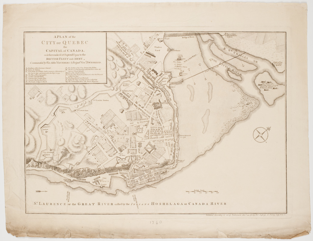
A Plan of the city of Quebec the capital of Canada. : As it surrendered 18 Septembr. 1759 to the British Fleet and Army, commanded by Vice Admiral Saunders, & Brigadr. Genl. Townshend
This map is also available in American Revolutionary Geographies Online (ARGO), a collections portal especially built for material relating to the American Revolutionary War Era. Visit ARGO to learn more about this item and explore the historical geography of North America in the late eighteenth century.
Item Information
- Title:
- A Plan of the city of Quebec the capital of Canada. : As it surrendered 18 Septembr. 1759 to the British Fleet and Army, commanded by Vice Admiral Saunders, & Brigadr. Genl. Townshend
- Description:
-
Subject: Map of Quebec City after the Seige of Quebec in 1759.
- Publisher:
- Jefferys, Thomas, -1771
- Date:
-
[1760]
- Format:
-
Maps/Atlases
- Location:
- American Antiquarian Society
- Collection (local):
-
American Antiquarian Society Collection
- Subjects:
-
Québec (Québec)--History--Siege, 1775-1776--Maps
Québec (Québec)--Maps
- Places:
-
CanadaQuébec
- Extent:
- 1 map : engraving ; 34 x 49 cm., on sheet 44 x 57 cm.
- Terms of Use:
-
Public Domain/No known restrictions on use. Contact host institution to download image.
Contact host institution for more information.
- Publisher:
-
[London] :
Published according to act of Parliament Janry. 15 1760 by Thos. Jefferys at Charing Cross, Price 2.
- Scale:
-
Scale [ca. 1:3,500]
- Language:
-
English
- Catalog Record:
-
http://catalog.mwa.org/vwebv/holdingsInfo?bibId=479077
- Notes:
-
Relief shown by hachures.
Oriented with north at upper right.
- Notes (date):
-
This date is inferred.


