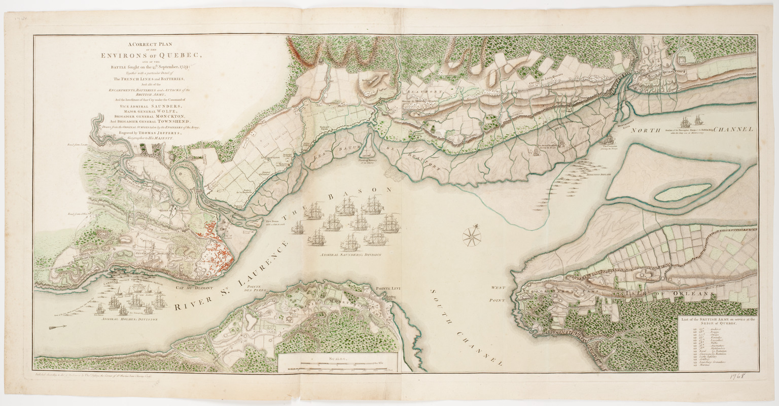
A Correct plan of the environs of Quebec, : and the battle fought on the 13th September, 1759: together with a particular detail of the French lines and batteries, and also of the encampments, batteries and attacks of the British army, and the investiture of that city under the command of vice admiral Saunders, Major General Wolfe, Brigadier General Monckton, and Brigadier General Townshend
This map is also available in American Revolutionary Geographies Online (ARGO), a collections portal especially built for material relating to the American Revolutionary War Era. Visit ARGO to learn more about this item and explore the historical geography of North America in the late eighteenth century.
Item Information
- Title:
- A Correct plan of the environs of Quebec, : and the battle fought on the 13th September, 1759: together with a particular detail of the French lines and batteries, and also of the encampments, batteries and attacks of the British army, and the investiture of that city under the command of vice admiral Saunders, Major General Wolfe, Brigadier General Monckton, and Brigadier General Townshend
- Description:
-
Subject: Map of the area near Quebec City showing the locations of battle and encampments during the Seige of 1759.
- Engraver:
- Jefferys, Thomas, -1771
- Name on Item:
-
Drawn from the original surveys taken by the engineers of the army. ; Engraved by Thomas Jefferys, geographer to His Majesty.
- Date:
-
[1768]
- Format:
-
Maps/Atlases
- Location:
- American Antiquarian Society
- Collection (local):
-
American Antiquarian Society Collection
- Subjects:
-
Québec Campaign, Québec, 1759--Maps
Québec (Québec)--History--Siege, 1775-1776--Maps
Québec (Québec)--Maps
- Places:
-
CanadaQuébec
- Extent:
- 1 map on 2 sheets : engraving, hand colored ; 41 x 89 cm., on sheets 48 x 45 cm.
- Terms of Use:
-
Public Domain/No known restrictions on use. Contact host institution to download image.
Contact host institution for more information.
- Publisher:
-
[London] :
Published according to act of Parliament by Thos. Jefferys, in the court of St. Martin's Lane Charing Cross.
- Scale:
-
Scale [ca. 1:18,500]
- Language:
-
English
- Catalog Record:
-
http://catalog.mwa.org/vwebv/holdingsInfo?bibId=478982
- Notes:
-
Relief shown by hachures.
Oriented with north at upper right.
From A general topography of North America, London, 1768.
- Notes (date):
-
This date is inferred.


