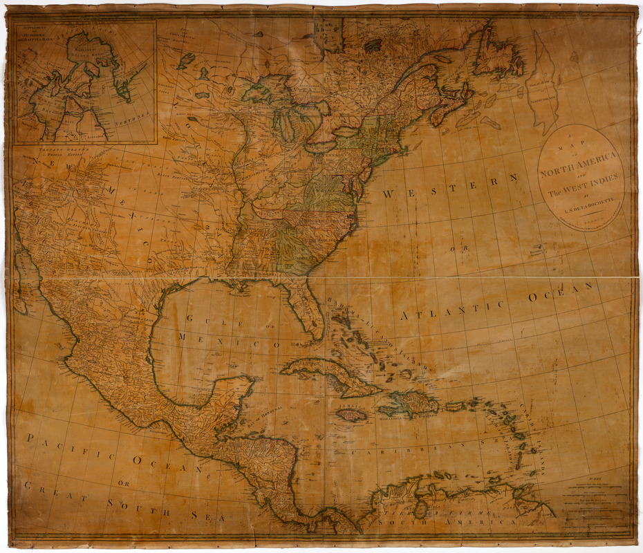
A map of North America and the West Indies
This map is also available in American Revolutionary Geographies Online (ARGO), a collections portal especially built for material relating to the American Revolutionary War Era. Visit ARGO to learn more about this item and explore the historical geography of North America in the late eighteenth century.
Item Information
- Title:
- A map of North America and the West Indies
- Creator:
- Delarochette, L. (Louis), 1731-1802
- Former owner:
- Carr, W.
- Bookseller:
- Wilkinson, Robert, -approximately 1825
- Publisher:
- Wilkinson, Robert, -approximately 1825
- Former owner:
- New England Historic Genealogical Society
- Name on Item:
-
By L.S. de la Rochette.
- Date:
-
[1795]
- Format:
-
Maps/Atlases
- Location:
- American Antiquarian Society
- Collection (local):
-
American Antiquarian Society Collection
- Subjects:
-
North America--Maps
- Places:
-
North America (area)
- Extent:
- 1 map on 4 sheets : engraving, hand colored ; 100 x 118 cm., on sheets 53 x 62 cm., or smaller
- Terms of Use:
-
Public Domain/No known restrictions on use. Contact host institution to download image.
Contact host institution for more information.
- Publisher:
-
London :
Published as the Act directs, the 1st of March, 1795, by Robt. Wilkinson, at no. 58 in Cornhill.
- Scale:
-
Scale [ca. 1:5,250,000]
- Language:
-
English
- Catalog Record:
-
http://catalog.mwa.org/vwebv/holdingsInfo?bibId=488958
- Notes:
-
Prime meridian: London and Ferro.
Relief shown pictorially.
Inset: Supplement for Hudsons and Baffins Bay.
- Notes (date):
-
This date is inferred.


