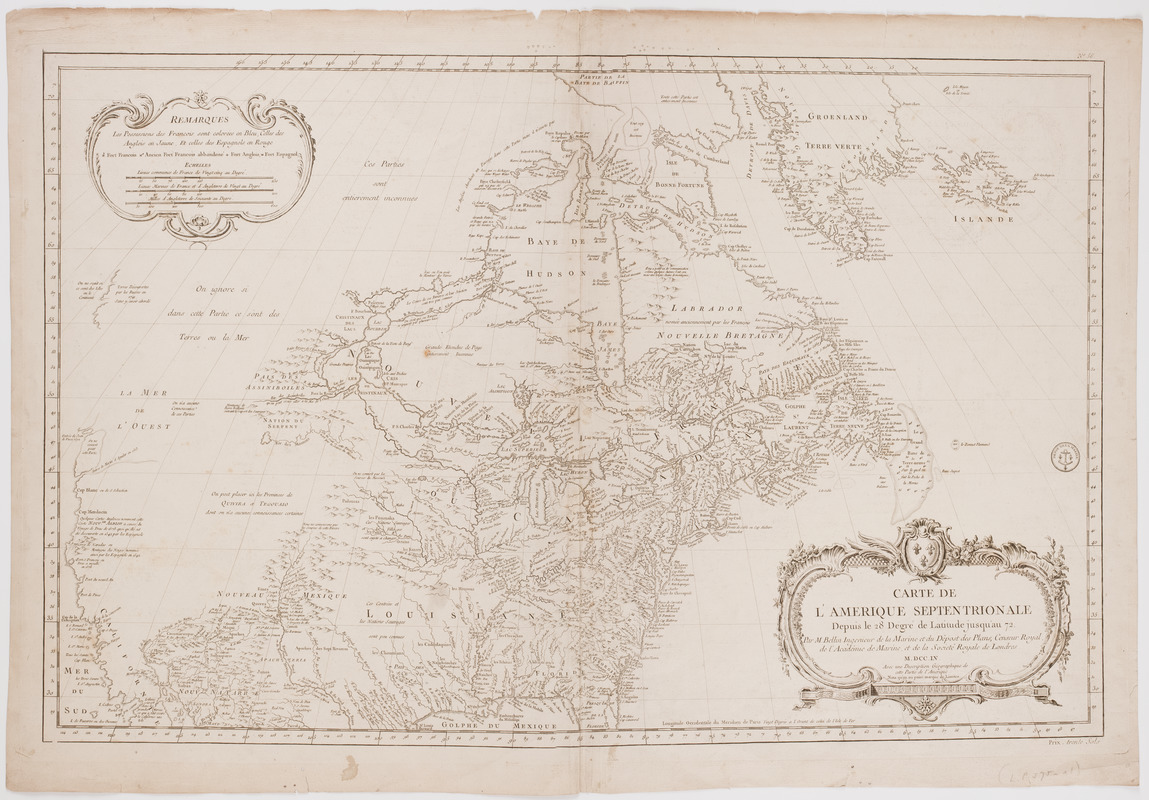
Carte de l'Amerique Septentrionale depuis le 28 degré de latitude jusqu'au 72
This map is also available in American Revolutionary Geographies Online (ARGO), a collections portal especially built for material relating to the American Revolutionary War Era. Visit ARGO to learn more about this item and explore the historical geography of North America in the late eighteenth century.
Item Information
- Title:
- Carte de l'Amerique Septentrionale depuis le 28 degré de latitude jusqu'au 72
- Description:
-
Subject: Map of North America showing Canada and the United States. Shows a large portion of the west undelineated, except for California.
- Creator:
- Bellin, Jacques Nicolas, 1703-1772
- Donor:
- Frost, Donald McKay, 1877-1958
- Name on Item:
-
Par M. Bellin ingenieur de la Marine et du dêpost des plans, censeur Royal de l'Académie de Marine, et de la Societé Royale de Londres. ; M.DCC.LV. Avec une description géographique de cette partie de l'Amerique. Nota qu'on na point marqué de limites.
- Date:
-
[1755]
- Format:
-
Maps/Atlases
- Location:
- American Antiquarian Society
- Collection (local):
-
American Antiquarian Society Collection
- Subjects:
-
North America--Maps
- Places:
-
North America (area)
- Extent:
- 1 map : engraving ; 56 x 86 cm., on sheet 64 x 92 cm.
- Terms of Use:
-
Public Domain/No known restrictions on use. Contact host institution to download image.
Contact host institution for more information.
- Publisher:
-
Paris :
[s.n.]
- Scale:
-
Scale [ca. 1:9,000,000]
- Language:
-
English
- Catalog Record:
-
http://catalog.mwa.org/vwebv/holdingsInfo?bibId=489635
- Notes:
-
Prime meridian: Paris.
Relief shown pictorially. Depths shown by soundings.
"No. 56."
"Prix, trente sols."
- Notes (date):
-
This date is inferred.


