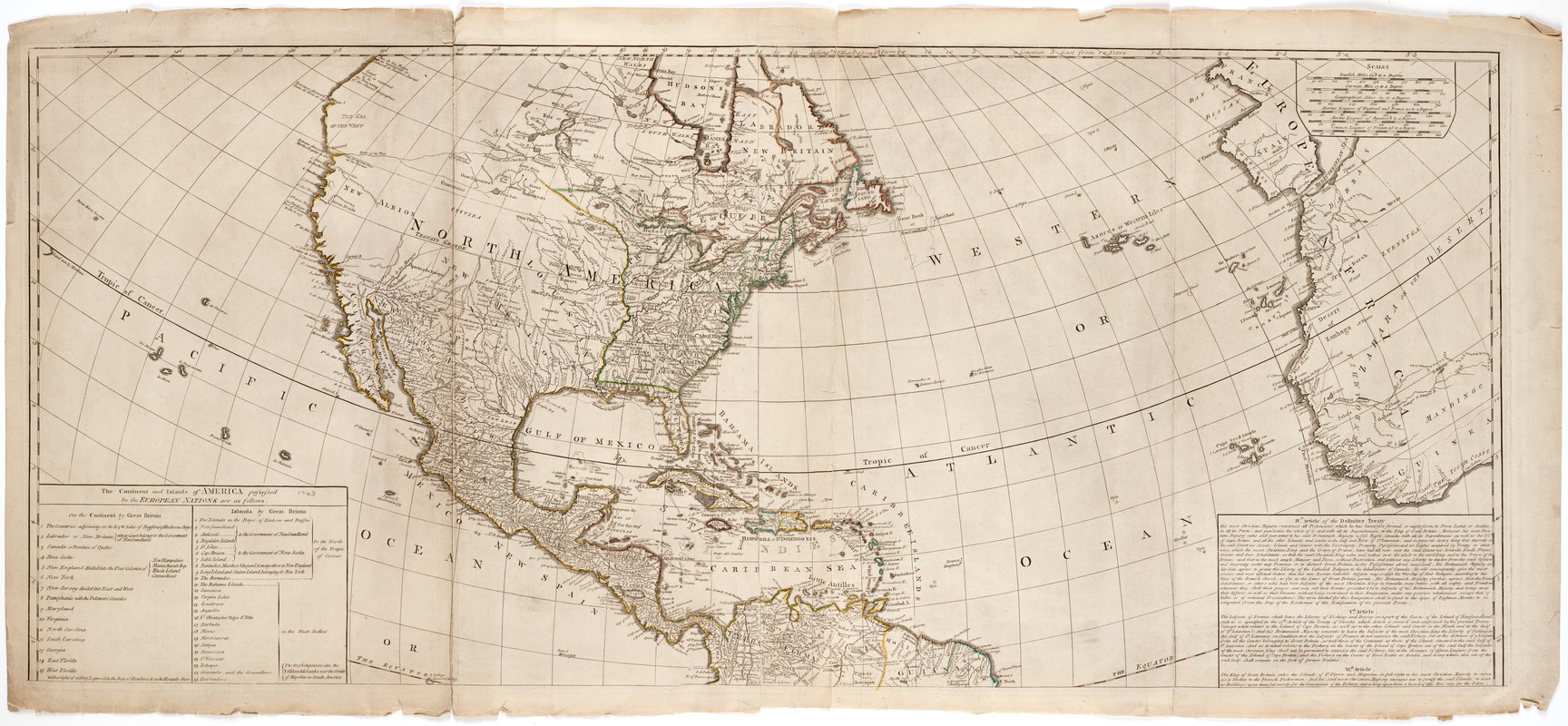
A New map of the whole continent of America, divided into North and South and West Indies. : With a descriptive account of the European possessions as settled by the difinitive treaty of peace at Paris Feby. 10th 1763
This map is also available in American Revolutionary Geographies Online (ARGO), a collections portal especially built for material relating to the American Revolutionary War Era. Visit ARGO to learn more about this item and explore the historical geography of North America in the late eighteenth century.
Item Information
- Title:
- A New map of the whole continent of America, divided into North and South and West Indies. : With a descriptive account of the European possessions as settled by the difinitive treaty of peace at Paris Feby. 10th 1763
- Description:
-
Subject: Map of the Western Hemisphere. Includes cartouche at bottom right with a native headpiece and quiver, a beaver and a crocodile or alligator, set in a landscape.
- Creator:
- Anville, Jean Baptiste Bourguignon d', 1697-1782
- Publisher:
- Robert Sayer and John Bennett (Firm)
- Name on Item:
-
Compiled from Mr. D'Anville's maps of that continent, and corrected in the several parts beloning to Great Britain, from the original materials of Governor Pownall, M.P.
- Date:
-
1777
- Format:
-
Maps/Atlases
- Location:
- American Antiquarian Society
- Collection (local):
-
American Antiquarian Society Collection
- Subjects:
-
North America--Maps
South America--Maps
- Places:
-
North America (area)
South America
- Extent:
- 1 map on 4 sheets : engraving, hand colored ; 58 x 136 cm.
- Terms of Use:
-
Public Domain/No known restrictions on use. Contact host institution to download image.
Contact host institution for more information.
- Publisher:
-
London :
Printed for Robt. Sayer and John Bennett, no. 53 Fleet Street, as the Acti directs
- Scale:
-
Scale [ca. 1:13,000,000]
- Language:
-
English
- Catalog Record:
-
http://catalog.mwa.org/vwebv/holdingsInfo?bibId=488856
- Notes:
-
Prime meridian: Ferro.
Relief shown pictorially.
Inset: The supplement to North America containing the countries adjoining to Baffins & Hudsons bays.
"The continent and islands of America possessed by the European nations are as follows ... "
- Notes (date):
-
15th Feby. 1777


