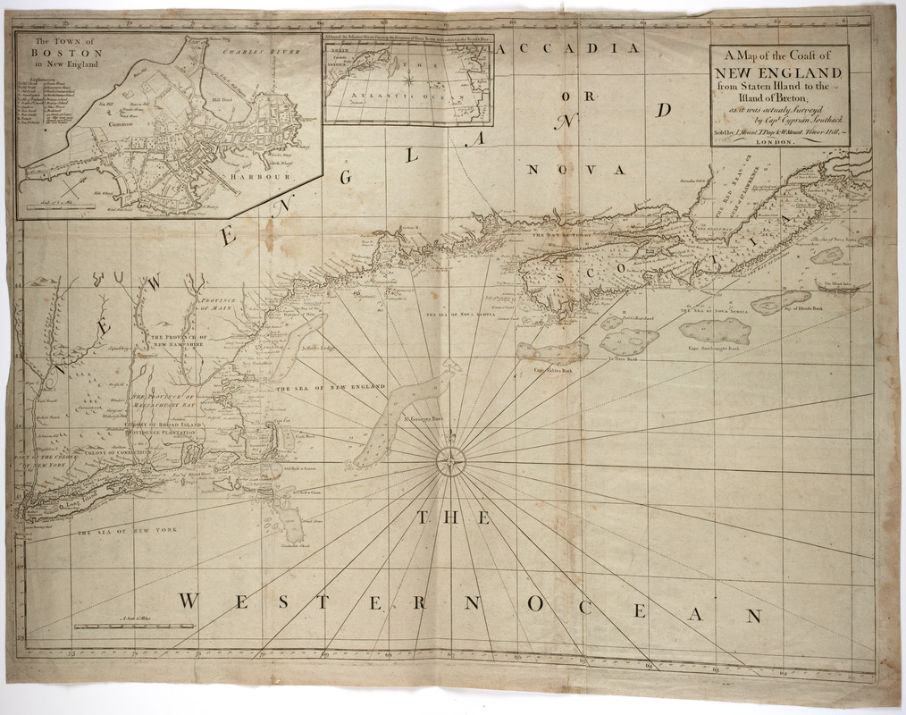
A map of the coast of New England from Staten Island to the island of Breton
This map is also available in American Revolutionary Geographies Online (ARGO), a collections portal especially built for material relating to the American Revolutionary War Era. Visit ARGO to learn more about this item and explore the historical geography of North America in the late eighteenth century.
Item Information
- Title:
- A map of the coast of New England from Staten Island to the island of Breton
- Title (uniform):
-
English pilot
- Description:
-
Subject: Map of New England, Nova Scotia and the Atlantic Ocean with an inset of Boston.
- Creator:
- Southack, Cyprian, 1662-1745
- Donor:
- Farwell, John Whittemore, 1843-1929
- Publisher:
- W. & J. Mount & T. Page
- Name on Item:
-
as it was actualy survey'd by Capt. Cyprian Southack.
- Date:
-
[1775]
- Format:
-
Maps/Atlases
- Location:
- American Antiquarian Society
- Collection (local):
-
American Antiquarian Society Collection
- Subjects:
-
Boston (Mass.)--Maps
New England--Maps
- Places:
-
New England (area)
Suffolk (county)Boston
- Extent:
- 1 map on 2 sheets : engraving ; 61 x 81 cm., on sheets 65 x 56 cm. or smaller
- Terms of Use:
-
Public Domain/No known restrictions on use. Contact host institution to download image.
Contact host institution for more information.
- Publisher:
-
[London] :
Sold by I. Mount, T. Page & W. Mount. Tower Hill, London.
- Scale:
-
Scale [ca. 1:1,425,000]
- Language:
-
English
- Catalog Record:
-
http://catalog.mwa.org/vwebv/holdingsInfo?bibId=483348
- Notes:
-
From The English pilot, the fourth book, 1775-1794.
Relief shown pictorially. Depths shown by soundings.
Inset: The town of Boston in New England.
Inset: A chart of the Atlantic Ocean shewing the situation of Nova Scotia with respect to the British Isles.
- Notes (date):
-
This date is inferred.

![[Map of New England, 31st]](https://bpldcassets.blob.core.windows.net/derivatives/images/commonwealth:wd3763094/image_thumbnail_300.jpg)


