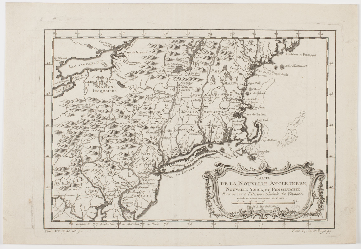
Carte de la Nouvelle Angleterre, Nouvelle Yorck, et Pensilvanie. : Pour servir à l'Histoire générale des voyages
This map is also available in American Revolutionary Geographies Online (ARGO), a collections portal especially built for material relating to the American Revolutionary War Era. Visit ARGO to learn more about this item and explore the historical geography of North America in the late eighteenth century.
Item Information
- Title:
- Carte de la Nouvelle Angleterre, Nouvelle Yorck, et Pensilvanie. : Pour servir à l'Histoire générale des voyages
- Description:
-
Subject: Map of New England, New York state, Pennsylvania and New Jersey.
- Creator:
- Bellin, Jacques Nicolas, 1703-1772
- Name on Item:
-
Par M.B. ing. de la Mare.
- Date:
-
[ca. 1757]
- Format:
-
Maps/Atlases
- Location:
- American Antiquarian Society
- Collection (local):
-
American Antiquarian Society Collection
- Subjects:
-
New England--Maps
New York (State)--Maps
Pennsylvania--Maps
- Places:
-
New England (area)
Pennsylvania
New York
- Extent:
- 1 map : engraving ; 21 x 30 cm., on sheet 25 x 37 cm.
- Terms of Use:
-
Public Domain/No known restrictions on use. Contact host institution to download image.
Contact host institution for more information.
- Publisher:
-
Paris :
[s.n.]
- Scale:
-
Scale indeterminable
- Language:
-
French
- Catalog Record:
-
http://catalog.mwa.org/vwebv/holdingsInfo?bibId=485077
- Notes:
-
Prime meridian: Paris.
Relief shown pictorially. Depths shown by soundings.
"Tom. XIV. in 4° no. 9. Tome 14 in 8° page 97."
From Prévost, A. Histoire générale des voyages, Paris, ca. 1757.

![[Map of parts of Pennsylvania, New York and New Jersey]](https://bpldcassets.blob.core.windows.net/derivatives/images/commonwealth:6108vt40m/image_thumbnail_300.jpg)


