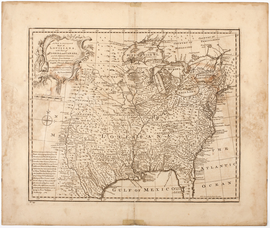
A new & accurate map of Louisiana, with part of Florida and Canada, : and the adjacent countries drawn from surveys assisted by the most approved English & French maps & charts
This map is also available in American Revolutionary Geographies Online (ARGO), a collections portal especially built for material relating to the American Revolutionary War Era. Visit ARGO to learn more about this item and explore the historical geography of North America in the late eighteenth century.
Item Information
- Title:
- A new & accurate map of Louisiana, with part of Florida and Canada, : and the adjacent countries drawn from surveys assisted by the most approved English & French maps & charts
- Description:
-
Subject: Map of the United States and Canada, showing Louisiana as the land west of the Appalachian Mountains to the border of New Mexico. Shows Florida stretching west to the Mississippi River. Shows the locations of various Native American tribes. Cartouche shows a Native American man.
- Creator:
- Bowen, Emanuel, -1767
- Name on Item:
-
The whole being regulated by astronl. observations, by Eman. Bowen.
- Date:
-
[1750]
- Format:
-
Maps/Atlases
- Location:
- American Antiquarian Society
- Collection (local):
-
American Antiquarian Society Collection
- Subjects:
-
Indians of North America--Pictorial works
United States--Maps
Louisiana--Maps
Florida--Maps
- Places:
-
Florida
Louisiana
- Extent:
- 1 map : engraving ; 35 x 42 cm., on sheet 45 x 53 cm.
- Terms of Use:
-
Public Domain/No known restrictions on use. Contact host institution to download image.
Contact host institution for more information.
- Publisher:
-
London :
[s.n.]
- Scale:
-
Scale [ca. 1:7,100,000]
- Language:
-
English
- Catalog Record:
-
http://catalog.mwa.org/vwebv/holdingsInfo?bibId=485237
- Notes:
-
Relief shown pictorially.
Based on maps by Bellin.
- Notes (date):
-
This date is inferred.


