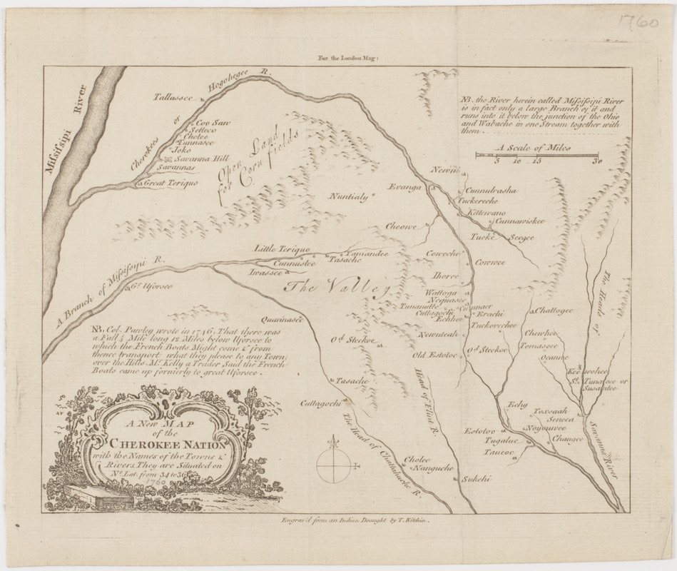
A New map of the Cherokee nation : with the names of the towns & rivers they are situated on No. lat from 34 to 36
This map is also available in American Revolutionary Geographies Online (ARGO), a collections portal especially built for material relating to the American Revolutionary War Era. Visit ARGO to learn more about this item and explore the historical geography of North America in the late eighteenth century.
Item Information
- Title:
- A New map of the Cherokee nation : with the names of the towns & rivers they are situated on No. lat from 34 to 36
- Title (uniform):
-
London magazine
- Description:
-
Subject: Map of the land belonging to the Cherokee Indians in and around the state of Georgia. Shows "open land for corn fields" and "the valley."
- Engraver:
- Kitchin, Thomas, 1718-1784
- Name on Item:
-
Engrav'd from an Indian draught by T. Kitchin.
- Date:
-
[1760]
- Format:
-
Maps/Atlases
- Location:
- American Antiquarian Society
- Collection (local):
-
American Antiquarian Society Collection
- Subjects:
-
Cherokee Indians--Land tenure--Georgia
Georgia--Maps
- Places:
-
Georgia
- Extent:
- 1 map : engraving ; 17 x 23 cm., on sheet 21 x 26 cm.
- Terms of Use:
-
Public Domain/No known restrictions on use. Contact host institution to download image.
Contact host institution for more information.
- Publisher:
-
London :
[s.n.]
- Scale:
-
Scale [ca. 1:1,013,000]
- Language:
-
English
- Catalog Record:
-
http://catalog.mwa.org/vwebv/holdingsInfo?bibId=488630
- Notes:
-
Relief shown pictorially.
From the February, 1760 issue of the London magazine.
"For the London mag:"
- Notes (date):
-
This date is inferred.


