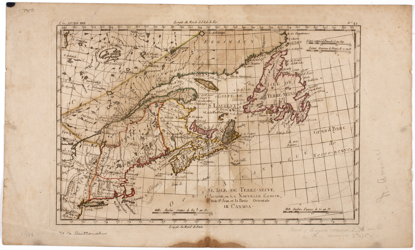
L'Isle de Terre-Neuve, l'Acadie, ou la Nouvelle Ecosse, : l'Isle St. Jean et la partie orientale du Canada
This map is also available in American Revolutionary Geographies Online (ARGO), a collections portal especially built for material relating to the American Revolutionary War Era. Visit ARGO to learn more about this item and explore the historical geography of North America in the late eighteenth century.
Item Information
- Title:
- L'Isle de Terre-Neuve, l'Acadie, ou la Nouvelle Ecosse, : l'Isle St. Jean et la partie orientale du Canada
- Description:
-
Subject: Map of New England and eastern Canada including Newfoundland, Nova Scotia and present day Quebec.
- Date:
-
[1780]
- Format:
-
Maps/Atlases
- Location:
- American Antiquarian Society
- Collection (local):
-
American Antiquarian Society Collection
- Subjects:
-
New England--Maps
Canada--Maps
Newfoundland and Labrador--Maps
Nova Scotia--Maps
- Places:
-
New England (area)
CanadaNova Scotia (province)
- Extent:
- 1 map : engraving, hand colored ; 21 x 32 cm., on sheet 26 x 43 cm.
- Terms of Use:
-
Public Domain/No known restrictions on use. Contact host institution to download image.
Contact host institution for more information.
- Publisher:
-
Geneva? :
[s.n.]
- Scale:
-
Scale [ca. 1:7,000,000]
- Language:
-
French
- Catalog Record:
-
http://catalog.mwa.org/vwebv/holdingsInfo?bibId=489707
- Notes:
-
Prime meridian: Paris and Ferro.
Relief shown by hachures.
"Liv. XV,XVI,XVII. No. 44."
Raynal, G.T. Histoire philosophique et politique, Geneva, 1780.
- Notes (date):
-
This date is inferred.


