A new chart of America : with the harbors, of Port Royal and Savannah &c
This map is also available in American Revolutionary Geographies Online (ARGO), a collections portal especially built for material relating to the American Revolutionary War Era. Visit ARGO to learn more about this item and explore the historical geography of North America in the late eighteenth century.
Item Information
- Title:
- A new chart of America : with the harbors, of Port Royal and Savannah &c
- Description:
-
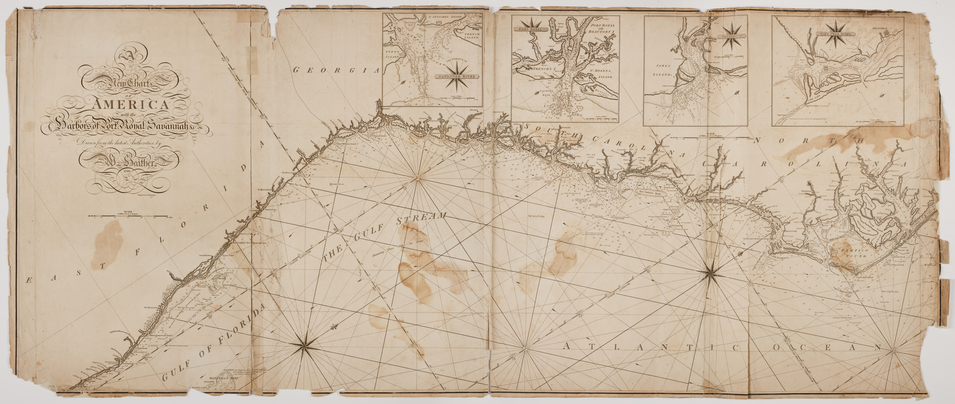
Subject: Nautical chart following the southeast coast of the United States from Albemarle Sound in North Carolina to near present day Fort Lauderdale, Florida. Includes four inset maps of Savannah, Georgia, Port Royal, South Carolina, Charleston, South Carolina and Cape Fear in North Carolina.
- Creator:
- Heather, William, 1764-1812
- Engraver:
- Stephenson, J., (Engraver)
- Publisher:
- Heather and Williams
- Name on Item:
-
Drawn from the latest authorities, by W. Heather, 1799. ; Engraved by J. Stephenson.
- Date:
-
[1799]
- Format:
-
Maps/Atlases
- Location:
- American Antiquarian Society
- Collection (local):
-
American Antiquarian Society Collection
- Subjects:
-
Southern States--Maps
Savannah (Ga.)--Maps
Port Royal (S.C.)--Maps
Charleston (S.C.)--Maps
Cape Fear River (N.C.)--Maps
- Places:
-
Southern United States (area)
Chatham (county)Savannah
Charleston (county)Charleston
Beaufort (county)Port Royal
- Extent:
- 1 map on 2 sheets : engraving ; 64 x 153 cm., on sheets 65 x 78 cm.
- Terms of Use:
-
Public Domain/No known restrictions on use. Contact host institution to download image.
Contact host institution for more information.
- Publisher:
-
London :
Heather and Williams
- Scale:
-
Scale [ca. 1:760,000]
- Language:
-
English
- Catalog Record:
-
http://catalog.mwa.org/vwebv/holdingsInfo?bibId=489801
- Notes:
-
Depths shown by soundings.
Oriented with north at upper right.
Insets: The entrance to Savannah River -- Port Royal -- Charleston -- Cape Fear River.
- Notes (date):
-
This date is inferred.


