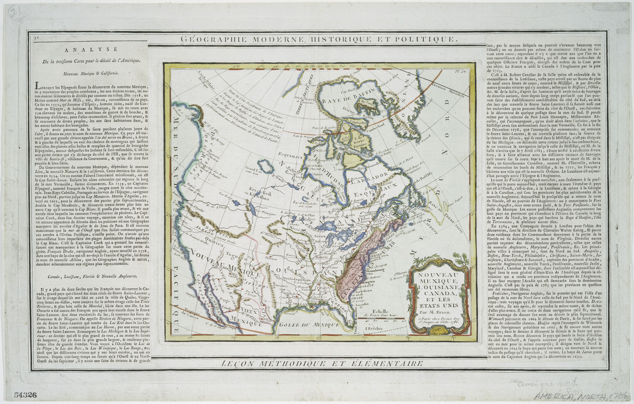
Nouveau Mexique, Louisiane, Canada, et les Etats Unis
This map is also available in American Revolutionary Geographies Online (ARGO), a collections portal especially built for material relating to the American Revolutionary War Era. Visit ARGO to learn more about this item and explore the historical geography of North America in the late eighteenth century.
Item Information
- Title:
- Nouveau Mexique, Louisiane, Canada, et les Etats Unis
- At head of map :
- Géographie moderne, historique et politique
- At foot of map :
- Leçon Méthodique et élémentaire
- Creator:
- Brion de la Tour, Louis, 1743-1803
- Contributor:
- Desnos, Louis-Charles, 1725-1805
- Name on Item:
-
par M. Brion, 1786.
- Date:
-
1786
- Format:
-
Maps/Atlases
- Location:
- New York Public Library
- Collection (local):
-
Lawrence H. Slaughter Collection of English maps, charts, globes, books and atlases
- Subjects:
-
Indians of North America--Maps
North America--Maps
- Places:
-
North America (area)
- Extent:
- 1 map : col. ; 22 x 25 cm. on sheet 33 x 52 cm.
- Terms of Use:
-
No known copyright restrictions.
This work is licensed for use under a Creative Commons Attribution Non-Commercial Share Alike License (CC BY-NC-SA).

- Publisher:
-
Paris :
Desnos
- Scale:
-
Scale not given
- Language:
-
French
- Catalog Record:
-
https://digitalcollections.nypl.org/items/510d47da-f104-a3d9-e040-e00a18064a99
- Notes:
-
Relief shown pictorially.
Shows boundaries for the United States, Florida, French Louisiana, and New Mexico; areas of Indian habitation, cities, settlements, and notable physical features.
Includes text notes.
In upper right corner: Pl. 51.
In left and right panels: [text in French] Analyse de la troisieme carte pour le détail de l'Amérique.


