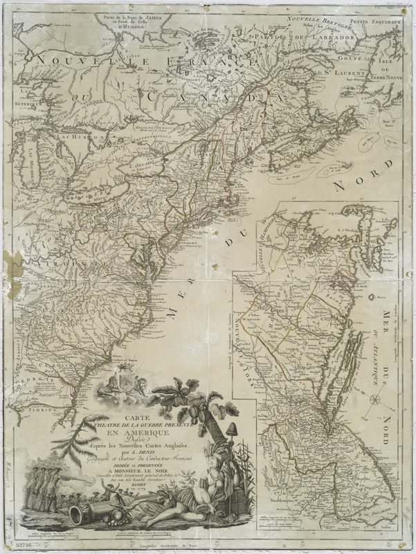
Carte du theatre de la guerre presente en Amerique
This map is also available in American Revolutionary Geographies Online (ARGO), a collections portal especially built for material relating to the American Revolutionary War Era. Visit ARGO to learn more about this item and explore the historical geography of North America in the late eighteenth century.
Item Information
- Title:
- Carte du theatre de la guerre presente en Amerique
- Title (alt.):
-
Theatre de la guerre presente en Amerique
- Creator:
- Denis, Louis, 1725-1794
- Contributor:
- Basset (Firm)
- Name on Item:
-
dressée d'après les nouvelles cartes anglaises par L. Denis.
- Date:
-
1779
- Format:
-
Maps/Atlases
- Location:
- New York Public Library
- Collection (local):
-
Maps of North America
- Subjects:
-
United States--Maps--Early works to 1800
- Places:
-
- Extent:
- col. map 67 x 51 cm.
- Terms of Use:
-
No known copyright restrictions.
This work is licensed for use under a Creative Commons Attribution Non-Commercial Share Alike License (CC BY-NC-SA).

- Publisher:
-
A Paris :
Chez Basset
- Scale:
-
Scale ca. 1:5,350,000
- Language:
-
French
- Catalog Record:
-
https://digitalcollections.nypl.org/items/510d47df-f987-a3d9-e040-e00a18064a99
- Notes:
-
Hand colored.
Prime meridian: Ferro and London.
Relief shown pictorially.
Includes inset of New Jersey to Massachusetts Bay, ca. 1:1,580,000.
- LCCN:
-
gm 71005489


