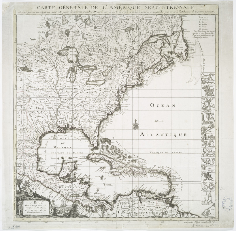
Carte générale de l'Amérique séptentrionale : avec les posséssions Angloises dans cette partie du nouveau monde
This map is also available in American Revolutionary Geographies Online (ARGO), a collections portal especially built for material relating to the American Revolutionary War Era. Visit ARGO to learn more about this item and explore the historical geography of North America in the late eighteenth century.
Item Information
- Title:
- Carte générale de l'Amérique séptentrionale : avec les posséssions Angloises dans cette partie du nouveau monde
- Creator:
- Le Rouge, Georges-Louis
- Contributor:
- Popple, Henry, -1743
- Contributor:
- Crépy (Firm)
- Name on Item:
-
dressée sur la carte de Pople [sic], publiée à Londres en 20 feuilles, pour servir à l'intelligence de la guerre présente.
- Date:
-
[1755?–1763?]
- Format:
-
Maps/Atlases
- Location:
- New York Public Library
- Collection (local):
-
Maps of North America
- Subjects:
-
North America--Maps--Early works to 1800
Great Britain--Colonies--America--Maps--Early works to 1800
- Places:
-
North America (area)
- Extent:
- 1 map : hand color ; 48 x 47 cm.
- Terms of Use:
-
No known copyright restrictions.
This work is licensed for use under a Creative Commons Attribution Non-Commercial Share Alike License (CC BY-NC-SA).

- Publisher:
-
Paris :
Chez Crepy rue St. Jacques à St. Pierre près la rue de la Parcheminerie
- Scale:
-
Scale [ca. 1:14,000,000]
- Language:
-
French
- Catalog Record:
-
https://digitalcollections.nypl.org/items/510d47da-eea0-a3d9-e040-e00a18064a99
- Notes:
-
Relief shown pictorially.
Prime meridians: Paris and London.
Includes list of abbreviations, decorative cartouche, compass rose and 18 insets.
French key map state 3, according to Babinski.
Author attribution and publishing date taken from Babinski's analysis of Popple's 1733 map.
Map attributed to Le Rouge based on reference in W.P. Cumming's Southeast in early maps, no. 216. The earliest edition of Le Rouge's map appeared ca.1742.
Map based on Henry Popple's Map of the British Empire in America, with the French and Spanish settlements adjacent thereto (1733).
Library's acquisition record dates the map 1755. The OCLC record is for a 1763? edition. There is no evidence on the map as to its specific date.


