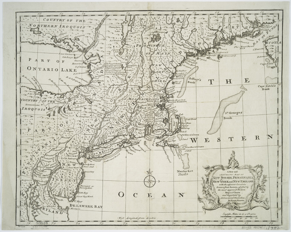
A new and accurate map of New Jersey, Pensilvania, New York and New England : with the adjacent countries. Drawn from surveys, assisted by the most approved modern maps & charts and regulated by astronomical observations
This map is also available in American Revolutionary Geographies Online (ARGO), a collections portal especially built for material relating to the American Revolutionary War Era. Visit ARGO to learn more about this item and explore the historical geography of North America in the late eighteenth century.
Item Information
- Title:
- A new and accurate map of New Jersey, Pensilvania, New York and New England : with the adjacent countries. Drawn from surveys, assisted by the most approved modern maps & charts and regulated by astronomical observations
- Creator:
- Bowen, Emanuel, -1767
- Name on Item:
-
By Eman. Bowen.
- Date:
-
[1747]
- Format:
-
Maps/Atlases
- Location:
- New York Public Library
- Collection (local):
-
Lawrence H. Slaughter Collection of English maps, charts, globes, books and atlases
- Subjects:
-
Northeastern States--Maps--Early works to 1800
- Places:
-
Northeastern United States (area)
- Extent:
- map 35 x 43 cm.
- Terms of Use:
-
No known copyright restrictions.
This work is licensed for use under a Creative Commons Attribution Non-Commercial Share Alike License (CC BY-NC-SA).

- Scale:
-
Scale ca. 1:2,250,000
- Language:
-
English
- Catalog Record:
-
https://digitalcollections.nypl.org/items/510d47db-c438-a3d9-e040-e00a18064a99
- Notes:
-
Relief shown pictorially.
From the author's A complete system of geography. 1747.
"No. 100."
- Notes (date):
-
This date is inferred.
- LCCN:
-
74693286


