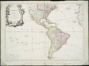
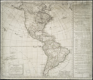
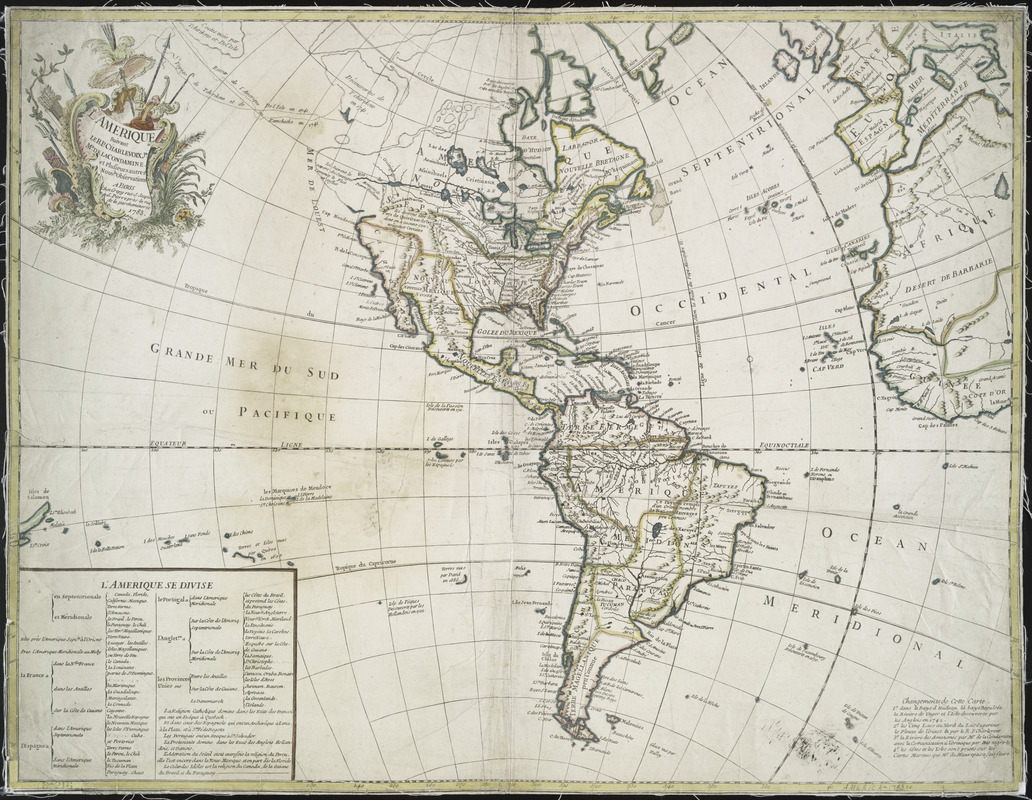
L'Amerique : suivant le R.P. Charlevoix Jte., Mr. de la Condamine, et plusieurs autres nouvle. observations
This map is also available in American Revolutionary Geographies Online (ARGO), a collections portal especially built for material relating to the American Revolutionary War Era. Visit ARGO to learn more about this item and explore the historical geography of North America in the late eighteenth century.
Item Information
- Title:
- L'Amerique : suivant le R.P. Charlevoix Jte., Mr. de la Condamine, et plusieurs autres nouvle. observations
- Creator:
- Crépy (Firm)
- Contributor:
- Charlevoix, Pierre-François-Xavier de, 1682-1761
- Contributor:
- La Condamine, Charles-Marie de, 1701-1774
- Date:
-
1783
- Format:
-
Maps/Atlases
- Location:
- New York Public Library
- Collection (local):
-
Maps of North and South America
- Subjects:
-
America--Maps--Early works to 1800
- Places:
-
North America (area)
South America
Mesoamerica (area)
- Extent:
- 1 map : hand col. ; 47 x 62 cm.
- Terms of Use:
-
No known copyright restrictions.
This work is licensed for use under a Creative Commons Attribution Non-Commercial Share Alike License (CC BY-NC-SA).

- Publisher:
-
Paris :
Chez Crepy, rue S. Jacque[s] à S. Pierre près la rue de la parcheminerie
- Scale:
-
Scale [ca. 1:40,000,000] at equator
- Language:
-
French
- Catalog Record:
-
https://digitalcollections.nypl.org/items/510d47db-b1fc-a3d9-e040-e00a18064a99
- Notes:
-
Relief shown pictorially.
Includes decorative cartouche, "L'Amerique se divise" (table of colonial powers and their territories), and "Changements de cette carte."