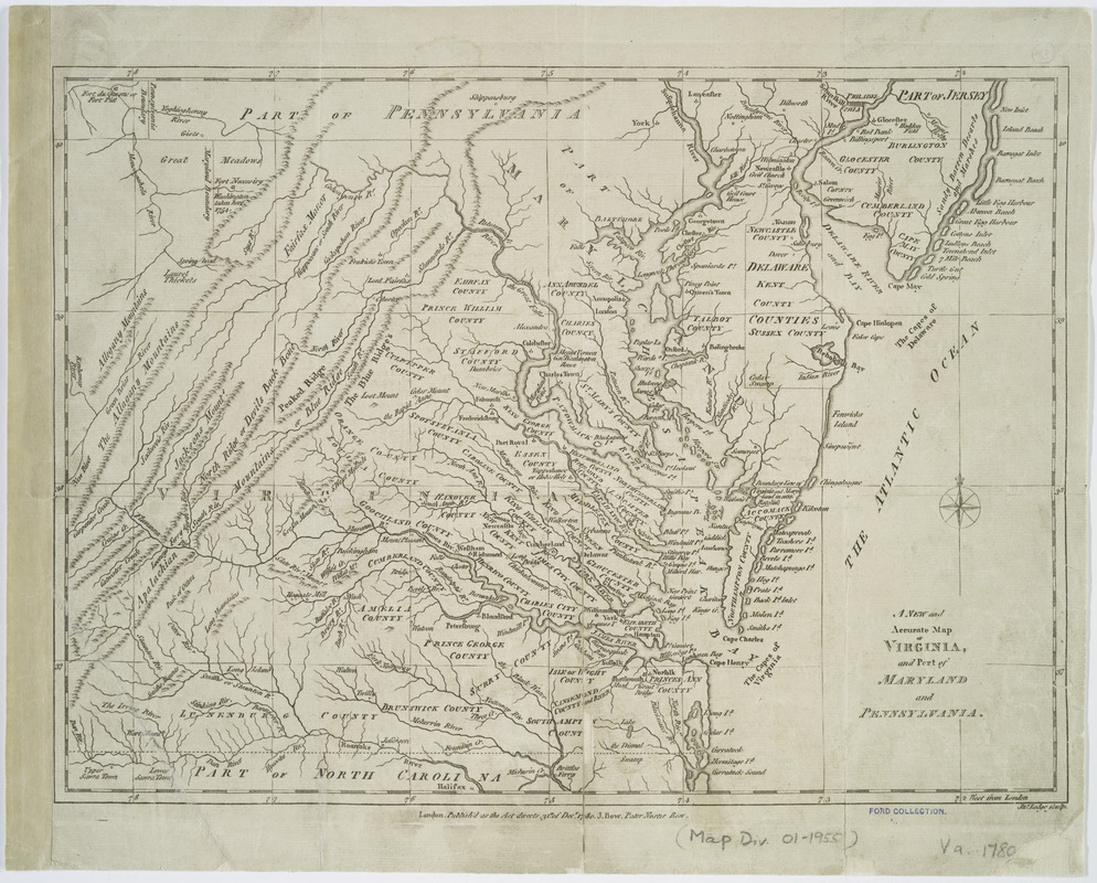
A New and accurate map of Virginia : and part of Maryland and Pennsylvania
This map is also available in American Revolutionary Geographies Online (ARGO), a collections portal especially built for material relating to the American Revolutionary War Era. Visit ARGO to learn more about this item and explore the historical geography of North America in the late eighteenth century.
Item Information
- Title:
- A New and accurate map of Virginia : and part of Maryland and Pennsylvania
- Name on Item:
-
Jno. Lodge, sculp.
- Date:
-
1780
- Format:
-
Maps/Atlases
- Location:
- New York Public Library
- Collection (local):
-
Maps of North America
- Subjects:
-
Virginia--Maps--Early works to 1800
Maryland--Maps--Early works to 1800
Pennsylvania--Maps--Early works to 1800
- Places:
-
Maryland
Pennsylvania
Virginia
- Extent:
- 1 map ; 27 x 37 cm.
- Terms of Use:
-
No known copyright restrictions.
This work is licensed for use under a Creative Commons Attribution Non-Commercial Share Alike License (CC BY-NC-SA).

- Publisher:
-
London :
J. Bew
- Scale:
-
Scale not given
- Language:
-
English
- Catalog Record:
-
https://digitalcollections.nypl.org/items/510d47da-f068-a3d9-e040-e00a18064a99
- Notes:
-
Relief shown pictorially.
Prime meridian: London.


