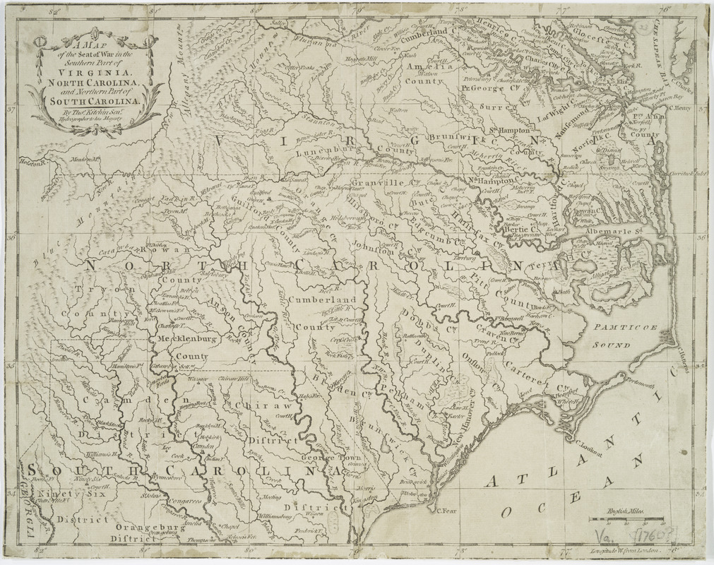
A map of the seat of war in the southern part of Virginia, North Carolina, and the northern part of South Carolina
This map is also available in American Revolutionary Geographies Online (ARGO), a collections portal especially built for material relating to the American Revolutionary War Era. Visit ARGO to learn more about this item and explore the historical geography of North America in the late eighteenth century.
Item Information
- Title:
- A map of the seat of war in the southern part of Virginia, North Carolina, and the northern part of South Carolina
- Creator:
- Kitchin, Thomas, 1718-1784
- Name on Item:
-
Thos. Kitchin, Senr.
- Date:
-
1781
- Format:
-
Maps/Atlases
- Location:
- New York Public Library
- Collection (local):
-
Maps of North America
- Subjects:
-
Virginia--Maps--Early works to 1800
North Carolina--Maps--Early works to 1800
South Carolina--Maps--Early works to 1800
- Places:
-
Virginia
North Carolina
South Carolina
- Extent:
- 1 map ; 26 x 34 cm. mounted on cardboard 36 x 42 cm.
- Terms of Use:
-
No known copyright restrictions.
This work is licensed for use under a Creative Commons Attribution Non-Commercial Share Alike License (CC BY-NC-SA).

- Publisher:
-
[London] :
R. Baldwin
- Scale:
-
Scale [ca. 1:1,710,000]
- Language:
-
English
- Catalog Record:
-
https://digitalcollections.nypl.org/items/510d47da-ee3f-a3d9-e040-e00a18064a99
- Notes:
-
Relief shown pictorially.
"London Mag: June 1781."

![Virginiae partis australis et Floridae partis orientalis, interjacentium[que] regionum nova descriptio](https://bpldcassets.blob.core.windows.net/derivatives/images/commonwealth:6t053p120/image_thumbnail_300.jpg)
![Virginiae partis australis, et Floridae partis orientalis, interjacentiumq[ue] regionum nova descriptio](https://bpldcassets.blob.core.windows.net/derivatives/images/commonwealth:st74cw930/image_thumbnail_300.jpg)


